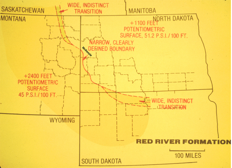
Figure 30. Map of the Dakotas and eastern Montana, showing of the boundary in the Red River Formation that separates potentiometric surface of +1100 feet and pressure gradient of 51.2 psi/100 feet, to the east and northeast, from the potentiometric surface of +2400 feet and pressure gradient of 45 psi/100 feet, to the west and southwest.