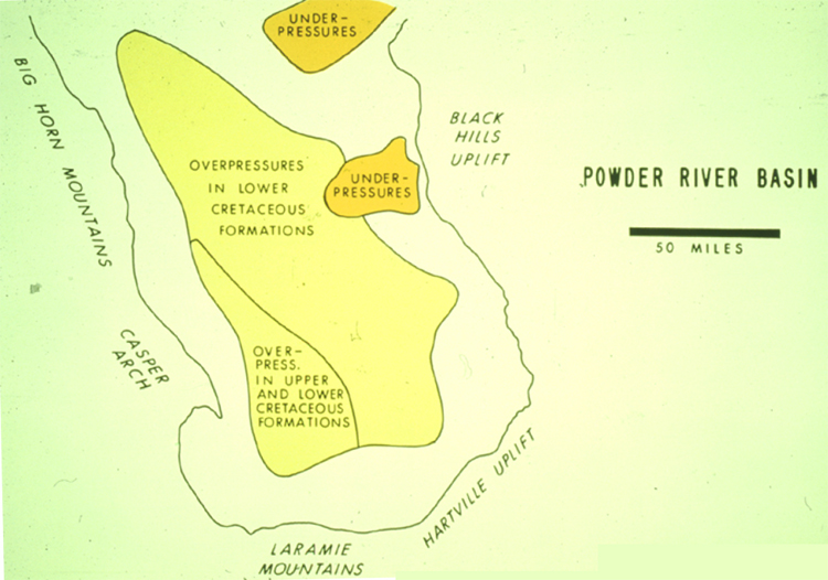
Figure 15. Map of Powder River Basin, with areal extents of overpressures and underpressures in Lower Cretaceous formations and overpressures in both Upper and Lower Cretaceous formations.
Figure 15. Map of Powder River Basin, with areal extents of overpressures and underpressures in Lower Cretaceous formations and overpressures in both Upper and Lower Cretaceous formations.