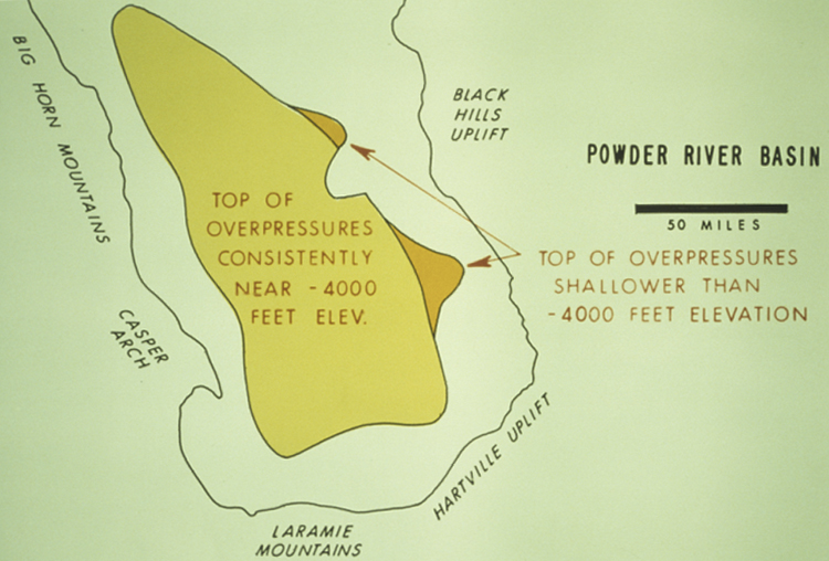
Figure 14. Map of Powder River Basin, with areal extent for top of overpressures near -4000 ft and extent for top of overpressures shallower than -4000 ft.
Figure 14. Map of Powder River Basin, with areal extent for top of overpressures near -4000 ft and extent for top of overpressures shallower than -4000 ft.