|
uJurassic
uLouisiana
uTexas
uReferences
uJurassic
uLouisiana
uTexas
uReferences
uJurassic
uLouisiana
uTexas
uReferences
uJurassic
uLouisiana
uTexas
uReferences
|
Jurassic
in Mississippi Salt Basin
Tertiary in Louisiana
Gulf coast
|
 |
Figure 2. Tectonic map of western
Gulf
Coast, as index for local
maps and cross-sections (after Watkins, 1996). Number on map
corresponds to figure number. |
|
 |
Figure 3. Cross-section, Bastian Bay
Field, Plaquemines Parish, Louisiana, with accumulations in
relation to shallowest point of overpressures (arrow). |
|
 |
Figure 4. Structure map and schematic
cross-section of pressure-enhanced trap, Gibson Field and
Humphreys fields, Terrebonne Parish, Louisiana. Pressure
parallels stratigraphy. Downthrown-block trap, with production
from Sub-Hollywood sands. At Gibson, seal is overpressured shale
mass in upthrown block; at Humphreys, seal is shale mass in
upthrown block to Lake Hatch fault. |
|
 |
Figure 5. Structure map and schematic
cross-section of pressure-enhanced trap, Wyandotte Field, St.
Mary Parish, Louisiana.
Pressure climbs stratigraphy. Upthrown block with production in
fault-closure trap above overpressures, which are lower than
they are in expanded downthrown block. |
|
 |
Figure 6. Cross-section and
pressure/depth profile, Ship Shoal Block 28 Field, offshore
Louisiana, showing intervals of seal in upthrown and downthrown
blocks, along with productive units in relation to shallowest
point of overpressures (in the upthrown block at the fault). |
|
 |
Figure 7. Structure map and schematic
cross-section of pressure-enhanced trap, Bayou Carlin Field, St.
Mary Parish,
Louisiana.
Pressure climbs stratigraphy, Pressure “halo” around shale mass
provides western seal for trap. |
|
 |
Figure 8. Cross-section, West Bayou
Carlin shale mass, St. Mary Parish,
Louisiana, showing distribution of
low-resistivity shale (overpressure) and of gas reservoirs. |
|
 |
Figure 9. Shale resistivities
highlighted on log of Amoco No. 1 S.L. 4427, West Bayou Carlin
shale mass, St. Mary Parish, Louisiana, with calculation of
pressure at base of seal. See
Figure 8 for location of well. |
|
 |
Figure 10. Pressure/depth profile of the
seal calculated from shale resistivities on log of Amoco No. 1
S.L. 4427, West Bayou Carlin shale mass, St. Mary Parish,
Louisiana. |
 |
Figure 11.
Structure map and schematic cross-section of pressure-enhanced
trap, Jeanerette Field, St. Mary Parish, Louisiana. Pressure
climbs stratigraphy. Upthrown block with Panulina production in
lower pressured system; downthrown block of expansion fault with
overpressure at higher position and non-productive expanded
Planulina section. |
|
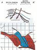 |
Figure 12.
Structure map and schematic cross-section of pressure-enhanced
trap, Bayou Pigeon and Bayou Postillion fields, Iberia Parish,
Louisiana. Pressure climbs stratigraphy. Updip high-pressured,
non-productive sands were encountered in same fault block as
productive sands. Pressure is updip seal. |
|
 |
Figure 13. Structure map and schematic
cross-section of pressure-enhanced trap, Duck Lake Field, St.
Martin Parish, Louisiana. Pressure parallels stratigraphy.
Overpressure and closure but no production in upthrown block;
closure and Discorbis B sand production in expanded downthrown
block above overpressures. |
|
 |
Figure 14. Structure map and schematic
cross-section of pressure-enhanced trap, Pecan Island Field,
Vermilion Parish, Louisiana. Pressure climbs stratigraphy.
Pressure “halo” forms updip seal for Discorbis B sand
accumulation on west flank. |
|
 |
Figure 15. Cross-section, Midland Field,
Acadia Parish, Louisiana, with normal pressures above
overpressures and between normal pressures in the easternmost
part of the section (after Fowler et al., 1971). |
|
 |
Figure 16. Structure map and schematic
cross-section of pressure-enhanced trap, South Pecan Lake,
Cameron Parish, Louisiana. Pressure parallels stratigraphy,
following units across faults, with accumulations in lower
pressure systems. |
|
 |
Figure 17. Cross-section, South
Thornwell salt dome, Jefferson Davis and Cameron parishes,
Louisiana, showing seal “halo” peripheral to the salt and
associated gas accumulation downdip from gas and water (after
Roach, 1962). |
Tertiary in Texas Gulf
Coast
|
 |
Figure 18. Cross-section and
pressure/depth profile, Alta Loma Field, Galveston County,
Texas, showing intervals of seal in upthrown and dowthrown
blocks, along with productive units in relation to shallowest
point of overpressures (in the upthrown block at the fault). |
|
 |
Figure 19. Seismic interval velocity
cross-section, Southern Mustang Island, offshore Texas, with
seal, determined from well control, approximately paralleling
interval velocities over much of the section but highly
discordant in the southeasternmost part. |
References
Roach, C.B.,
1962,
Intrusive shale dome in South Thornwell Field, Jefferson Davis and
Cameron parishes, Louisiana: AAPG Bulletin, v. 46, p. 2121-2132.
Fowler, W. A.,
Boyd, W. A.; Marshall, S. W. and Myers, R. L., 1971, Abnormal Pressures
in Midland Field, Louisiana, in Houston Geological Society
Abnormal Subsurface Pressure - A Study Group Report.
Return to top.
|
 Click to view article in PDF format.