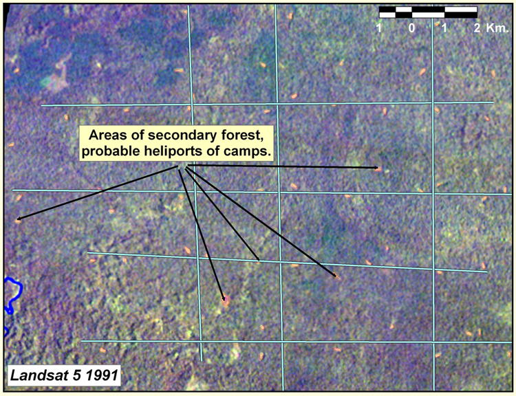
Landsat image, with faint rectangular areas, outlined by historic seismic lines, and areas of secondary forest, probable heliports of camps.
Landsat image, with faint rectangular areas, outlined by historic seismic lines, and areas of secondary forest, probable heliports of camps.