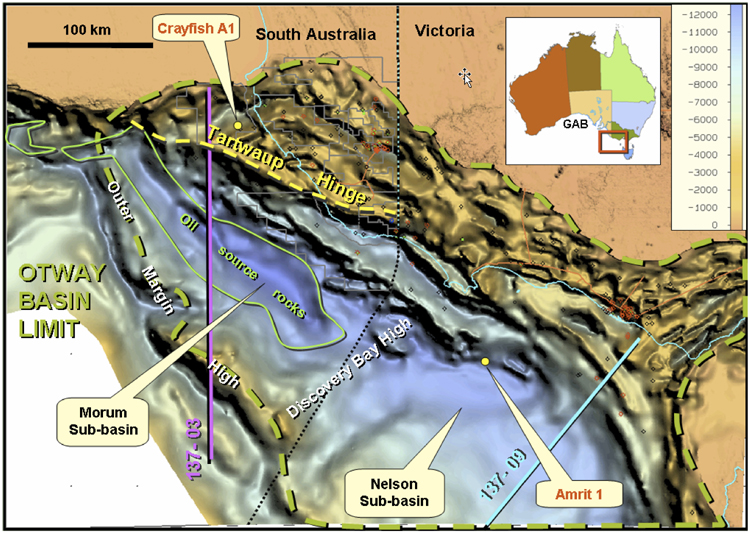
Figure 1: Otway Basin sediment thickness map*, showing the location of seismic lines used in the calculation of extension rates and wells mentioned in the text. GAB = Great Australian Bight *Calculated by subtracting SEEBASE ™ from the elevation data.