Tectonics and Hydrocarbon Systems of the East Gobi Basin, Mongolia*
By
Gary L. Prost 1
Search and Discovery Article #10090 (2005)
Posted September 3, 2005
*Oral presentation at AAPG Annual Convention, Calgary, Alberta, June 19-22, 2005
![]() Click
to view presentation in PDF format.
Click
to view presentation in PDF format.
1ConocoPhillips Canada, Calgary, AB ([email protected])
Abstract
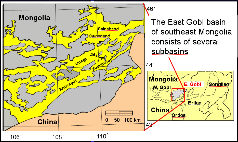
Mapping and seismic data in the East Gobi basin reveal a structural and burial history for basins adjacent to the Zuunbayan and Tsagaan Els oil fields. The tectonic framework was combined with available well and outcrop data to model the timing and magnitude of hydrocarbon generation.
Five structural episodes are recognized: 1) pre-Jurassic northeast-directed shortening that formed the tectonic fabric; 2) Middle Jurassic to Early Cretaceous rifting along northeast trends that formed the sub-basins of the East Gobi basin; 3) late Early Cretaceous north-south shortening and inversion on existing normal faults; shortening caused left-lateral and reverse displacements on northeast-trending faults; 4) middle Cretaceous uplift and erosion, followed by 5) east-west shortening and right-lateral movement on northeast faults. Folds formed by inversion over Late Jurassic-Early Cretaceous normal faults.
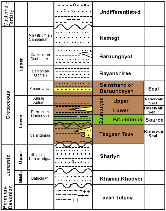
Modeling suggests that the bituminous member of the Zuunbayan Formation should be mature over large areas. Oil migrated from mature source areas toward several traps, including the Zuunbayan and Tsagaan Els fields. Modeling suggests that early oil was generated in the Zuunbayan and Tsagaan Els area because of Cretaceous burial. Although generation began in Early Cretaceous, peak generation occurred between 100-90 Ma. Generation continued at a decreasing rate to the present. Kerogen maturity suggests that oil is the most likely product. Calculations of hydrocarbon volumes generated indicate that the Unegt basin may have generated up to 86 billion BOE.
Conclusions
Five structural episodes are recognized:
1. Pre-Jurassic NE shortening
2. Mid-Jurassic to Early Cretaceous rifting on NE trends
3. Late Early Cretaceous N-S shortening
4. Middle Cretaceous uplift and erosion
5. E-W shortening and right-lateral offset on NE faults
Imagery identifies light-colored intrusives that may serve as a source of high-quality reservoir.
The bituminous member of the Zuunbayan Formation should be mature over much of the deep Unegt and Zuunbayan subbasins.
Oil generation began at 110 Ma, peaked 100-90 Ma, and continues to present.
As much as 86 BBOE may have been generated; least 650 MMBO accumulated (156 MMBO discovered).