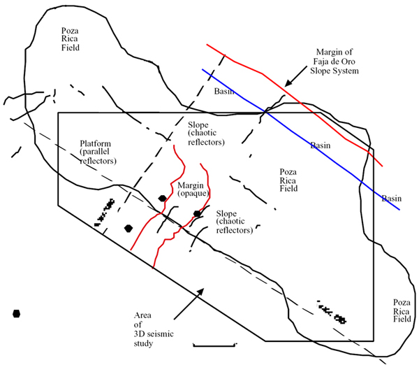
Figure 2a. Location map, showing the Poza Rica field outline, extent of 3D seismic data studied, identified faults (black), and position of opaque-seismically-defined platform margin facies and cored wells on either side of the margin. To the northeast is the basin axis between the Faja de Oro slope to the northeast and the Poza Rica high to the southwest.