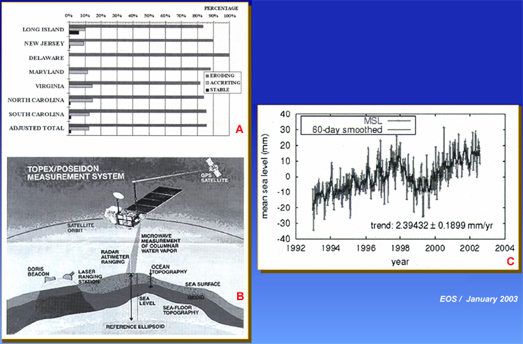
Figure 30. Sea level and coastal erosion satellite monitoring. A. Shoreline conditions along the U.S. East Coast. B. TOPEX/Poseidon measurement system (from JPL, 2004). Global sea level rise can be determined with considerable precision from the Topex/Poseidon satellite. C. Sea level data from the Topex/Poseidon satellite.