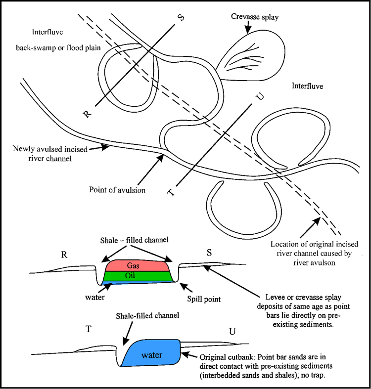
Figure. 8. Hypothetical meander belt (after differential compaction of sands and shales and tilting of strata), showing shale-filled channels (or oxbow lakes) and overlying shale which entrap hydrocarbons in some point bar sands but not in others. Widespread shaly beds, which overlie the point bar sands (and shale-filled channels) and constitute a roof-seal, are not shown.