Click on image for enlargement.
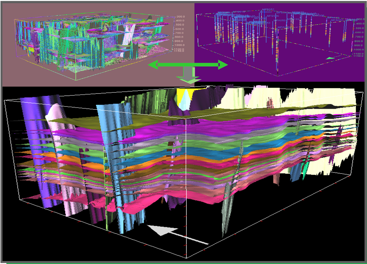
Figure 3. Using the four seismic horizons and geologic markers, application CPS3© generated the other horizons that complete the 3D Geological Model. In the upper left is the structural model with the four seismic horizons and interpreted faults; in the upper right are all the markers defined in all the wells studied. The lower image shows all the generated horizons.