Wyodak Coal, Tongue River Member of the Fort Union Formation, Powder River Basin, Wyoming: "No-Coal Zones" and Their Effects on Coalbed Methane Production*
![]() Click
to view presentation in PDF format.
Click
to view presentation in PDF format.
The Powder River Basin contains more than 80 percent of the state's coal resources within the Tongue River Member of the Fort Union Formation (upper Paleocene). The Fort Union Formation is divided from older to younger into the Tullock, Lebo Shale, and Tongue River Members. The coals of the Tongue River Member consist of approximately 32 coal seams with a combined thickness in excess of 300 ft. One of the major coal seams within the Tongue River Member is the Wyodak coal.
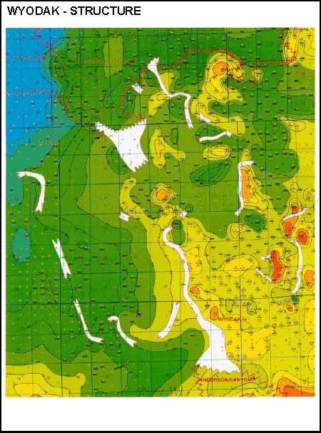
The Tongue River Member of the Fort Union Formation was deposited by a fluvial-deltaic system filling Lake Lebo. Extensive peat deposits accumulated within poorly drained interdeltaic and deltaic swamps. There are “no-coal zones” within the Wyodak coal seam where the coal has been replaced by sandstones and shales. The “no-coal zones” are distributary fluvial channels that meandered throughout the swamps. Several methods have been developed to predict the locations of the fluvial channels and avoid drilling “no-coal zones.” Additionally, the relationship between adjacent coal seams may imply a pattern of production.

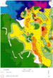
Geologic map of Powder River Basin (after Flores and Bader, 1999), with study area

Depositional environment of Wyodak coal
Reference
R.M. Flores and L.R. Bader, 1999, Fort Union Coal in the Powder River Basin, Wyoming and Montana: A synthesis, in 1999 Resource Assessment of Selected Tertiary Coal Beds and Zones in the Northern Rocky Mountains and Great Plains region: U.S. Geological Survey Professional Paper 1625-A, Chapter PS, p. i-iv, 1-71.