Click on image to view enlargement.
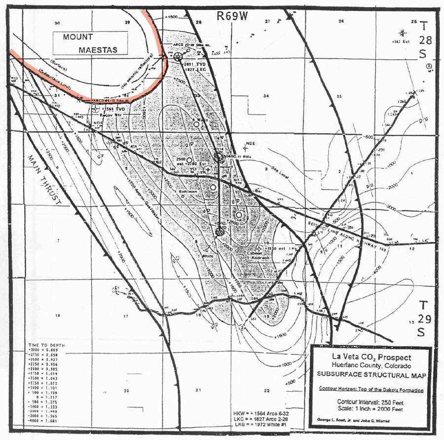
Figure 7. Structure map on top of the Cretaceous Dakota Sandstone with a contour interval of 250 feet. Shaded area shows potential gas-productive area in main anticline above gas/water contact of +1750 feet. Note locations of three seismic lines and the well control.