![]() Click to view article in PDF format.
Click to view article in PDF format.
Coalbed Methane Potential and Activity of the Illinois Basin*
By
Steven Tedesco1
Search and Discovery Article #10058 (2004)
*Adapted from “extended abstract” for presentation at the AAPG Annual Meeting, Salt Lake City, Utah, May 11-14, 2003.
Two other articles on coalbed methane accompany this presentation; they are: Frontier Areas for Coalbed-Gas Exploration in Utah, by David E. Tabet and Jeffrey C. Quick, and Coalbed Methane Potential and Activity of the Western Interior Basin,, by Steven Tedesco.
1Dorado Gas Resources LLC, Englewood, CO; current address: 16746 E. Prentice Circle, Aurora, CO 80015-4130 ([email protected])
Background
The Illinois Basin is an elliptical intercratonic basin that covers approximately 34 million acres in Illinois, Southwestern Indiana and Western Kentucky (Figure 1). All coals of economic interest are found in the Pennsylvanian-aged strata in which 75 individual seams have been identified and of which 20 have been actively mined since the 1800s. The coals that have potential for gas production are found in the middle and upper Lower Pennsylvanian rocks of the Carbondale and Spoon formations. These coals vary in thickness from a few inches to over fifteen feet. The coals vary in rank from high volatile A in the southern part of the basin grading to high volatile bituminous C on the eastern, northern and western flanks. Active mining is generally limited to areas where the coal is less than 600 feet thick. Coalbed methane exploration and exploitation has been sporadic since the mid-1980s. One coalbed methane project in Indiana has been reported to be producing since 2000 but is not considered economic, and two other pilots in Central and Southern Illinois are presently in the dewatering stage. Other pilots have either been temporarily abandoned or have failed because of the operator problems or poor reservoir characteristics. The focus of coalbed methane production in the basin for the past fifteen years has been gas production from numerous abandoned mines located around the rim of the basin. Gas content for many of the coals vary from 10 to over 250 scf per ton with the main seams varying between 50 to 150 scf per ton. Adsorption values range from 100 to 225 scf per ton. The coals and associated shales in the Illinois Basin are an attractive potential gas resource because of their location in relation to major gas markets in St. Louis, Chicago and Indianapolis. The road network, large agricultural base, existing petroleum infrastructure, favorable regulatory bodies, almost 100% fee acreage, and present lack of environmental opposition are factors favoring coalbed methane exploitation in the Illinois Basin.
|
|
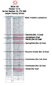
Geologic SettingThe Illinois Basin began as a rift complex that failed and evolved into a rapidly subsiding Paleozoic cratonic embayment that was structurally closed by major tectonic events in post Pennsylvanian time (Leighton et al., 1990). The basin was at one time part of an extensive continental-wide Pennsylvanian deltaic system that included, but was not limited to, the Western Interior, Black Warrior, Michigan, and Appalachian basins. The Illinois Basin is bounded by several major arches that have separated it from adjacent basins. The basin contains several large anticlinal features that have produced over 4 billion barrels of oil from depths generally less than 2500 feet from Mississippian, Devonian, Silurian and Ordovician reservoirs since the late 1800s. All of the significant coals in the Illinois Basin are found in the Pennsylvanian rocks that are concealed by a thin veneer of Pleistocene sediments. The present maximum thickness of the Pennsylvanian strata is approximately 2500 feet. The Pennsylvanian sediments were deposited unconformably on older rocks following a major period of uplift and erosion at the end of the Mississippian (Willman, 1975). The Pennsylvanian rocks were generally deposited in a marine to upper deltaic environment on a shallow cratonic platform. Within the Pennsylvanian rocks there are over 51 identified cyclothems in the Illinois Basin. The coals that can be exploited for coalbed methane potential are confined to the Carbondale and Spoon formations of Desmoinesian age (Figure 2). Other coals present in overlying and underlying formations have limited lateral extent and seem to be barren of gas. The main coal seams that are actively mined or have potential for coalbed methane are the Danville (No. 7), Jamestown, the Herrin (No. 6), the Briar Hill (No. 5A), the Springfield (No. 5), Houchin Creek (No. 4), Colchester (No. 2) and Seelyville and its equivalents such as the Davis and Dekoven coals. These coals are laterally extensive,m covering a vast majority of the basin and have been extensively mapped. Major distributary channel systems have been mapped in the No. 5 and No. 6 coal seams because of the extensive mining involving these coals. Major black shales in the Illinois Basin that overlie some of the coals are the Excello Shale which overlies the Houchin Creek (No. 4), the Dykersburg Shale, and the Anna Shale that overlies the Herrin (No. 6) coal. The coals in the Illinois Basin range from High Volatile A from the depositional center in Southern Illinois and Western Kentucky trending toward High Volatile C on the fringes of the basin to the north, east, and west.
Coalbed FeaturesAn expected aggregate net thickness of coals in the Carbondale and Spoon formations in the Illinois Basin is 15 to 45 feet except in areas of outcrop or subcrop. The BTU content of the coal varies from 11,000 to 15,500 DMMF. Moisture content varies from 5% to 19%; ash content varies from 1% to 25%; and volatile matter content varies from 28% to 41%. Gas content for the Illinois Basin varies from a low of 5 to 6 Scf per ton along the shallow areas of the basin, 80 to 150 scf per ton in the center part of the basin, to 40 to 230 scf per ton in the areas of higher rank coals in the southern part of the basin. Adsorption data is generally ranging from 150 to 225 scf per ton. Gas content indicates the coals are under-saturated based on present methods of analysis. Permeability measurements to date have been estimated via injection fall-off tests and indicate in the higher scf per ton areas in Southern Illinois and Western Kentucky that permeability is generally in the microdarcy to less than 10 millidarcies range. Permeability data in the central part of the basin varies from the single digits to over 50 millidarcies. Gas quality data is limited. Recently collected data indicates85% to 98% methane, 1% to 6% C2 through C4 with the remainder being nitrogen and trace amounts of carbon dioxide. BTU content has been reported to be as low as 450 (gob or mine gas) to as high as 1050 BTU. Based on isotopic analysis, the gas seems to be predominantly biogenic, with a minor thermogenic composition.
Coalbed Methane History and ActivityThere is one non-mine or non-gob well that has produced from the virgin coals prior to 1995. That well produced gas from unidentified coals and provided lighting for Hidalgo, Jasper County. The well reportedly was completed in the early 1920s in a coal seam(s) and was used for public lighting of streetlights for a town of approximately 800 people. The well was abandoned in the early 1930s. There has been no underground mining within 30 miles of the town. There have been indications of gas flows or shows from coals in Illinois while drilling along the La Salle Anticline in Eastern Illinois and flows of gas when drilling exploration holes for coal in Daviess County, Indiana. Presently, there is one project producing from virgin coals that consists of over 25 wells in Vigo and Sullivan counties and is operated by BPI of Vancouver, British Columbia and Pulse Energy of Evansville, Indiana. The wells produce from the Seelyville coal seam at 300 to 500 feet. The Seelyville coal in this area is 3 to 7 feet thick. Water rates are reported to be 10 to 300 barrels a day with gas production beginning several weeks after production is started. Gas rates have been reported at 10 to 150 MCFGPD. No scf per ton data are available; it is reported that the project has been underway for sometime, but no production data are available inasmuch as they currently are held confidential by the State of Indiana. However, the project is not considered to be economic. Most of the past and present activity is concentrated in areas of historical coal mining in southern Illinois, in Franklin, Saline, Gallatin, Williamson, Hamilton and White counties (Figure 3). Several operators, Berry Petroleum (Bakersfield, California), Dorado Gas Resources LLC (Englewood, Colorado), DeMier Oil (Mt. Vernon, Illinois), BPI Industries (Vancouver, Canada), Peabody Coal (St. Louis), and CH4 (Harrisburg, Illinois) continue to attempt moving projects into the pilot stage or from the pilot stage to full production. Around the basin there are several wells that have been drilled and completed in abandoned mines. Flow rates have varied from less than 100 MCFGPD to over 14 MMCFGPD. The gas quality ranges from 30% to 90% methane with the remainder typically nitrogen. The gas is either sold to existing pipelines or local end-users. Initial flow rates from these wells are typically strong followed by rapid decline. The focus in the basin is presently dominated by multiple zone completions of several coals. There are several coals that can be grouped into packages, such as the No. 5 through the No. 7 coal; the Seelyville, Davis, Dekoven and Colchester coals. In some areas the strata between the coals can be significant, whereby it will require individual seam completion. Some coals, such as the Houchin Creek No. 4, are typically isolated within the geologic section and may not be considered economic and may have to remain behind pipe. Gob wells require drilling into an exiting pillar or a few feet above the mine, set pipe and then drill or frac into a dry part of the mine and produce. To date the water produced from the coalbed methane gas wells in Saline, Williamson, Franklin, and White counties, Illinois, has been saline. Wells that have produced water from unmined coal seams in Illinois are slightly saline and require subsurface disposal. Produced water from the wells in Indiana has been reported to be potable and is presently being disposed of on the surface. There are several potential disposal zones, Pennsylvanian sandstones in the lower part section and several carbonates or sandstones in the Mississippian strata. The vast majority of the land in the Illinois Basin is held in fee. Invariably in areas where there is oil and gas production there are split minerals present. In the southern part and western part of the basin many coal-mining companies own individual seams through conveyances via coal severances in the areas that are presently or have historically been mined. In the central part of the basin these types of severances do not exist. These severances are a major roadblock to developing coalbed methane resources in areas where the No. 5 and No. 6 coals lie along the shallower parts of the basin. Land use in the Illinois Basin is predominately farming. Population density is high in certain areas due to the proximity to major interstates and cities such as St. Louis, Peoria, Effingham, and Springfield.
PotentialEstimates of potential coal gas resources for the Illinois Basin have been identified to be up to 21 TCF by the Gas Research Institute (now known as GTI). This resource evaluation of gas in-place was based on estimates using coal rank, depth, gas content, seam thickness, and lateral continuity in the basin. Based on new data being collected in the basin, the resource seems to be considerably less but significant. Potential reserves on a per well basis are unknown. Based on existing gas scf per ton and using 15 to 30 feet of net coal in the Carbondale and Spoon formations, expected gas in-place reserves will probably range from 1.5 to 5 BCF of gas per section depending on recovery factors, location in the basin, and depth. The potential for the basin seems to be 3 to 11 TCF of gas in place.
The present negatives for the Illinois Basin are:
The positives for the Illinois Basin are:
ReferencesArcher, P.L., 1979, Illinois Basin Report, Pennsylvanian Geology and Coal and Coalbed Methane Resources of the Illinois Basin, Illinois, Indiana and Kentucky: TRW Energy Systems Group, Contract No. DE-AC21-78MC08089. Archer, P.L., and J.N. Kirr, 1984, Pennsylvanian Geology, Coal, and Coalbed Methane Resources of the Illinois Basin -- Illinois, Indiana, and Kentucky, in Craig T. Rightmire et al., eds., Coalbed Methane Resources of the United States: AAPG Studies in Geology Series #17, p 105-134. Damberger, Heinz H., 1999, Miscellaneous Information on Coals, Coalbed Methane and Coal Mine Methane in the Illinois Basin: Illinois Geological State Survey, Handout, 30p. Demir, I., and H.H. Damberger, 2000, Coalbed and Coal Mine Methane Potential of Illinois Basin: Rocky Mountain Association of Geologists, 2000 Coalbed Methane in the Rocky Mountains Symposium, Denver, Colorado. Smath, Richard A., David A. Williams, James C. Cobb, and Barry W. Fisher, 1985, Feasibility Assessment of Unconventional Gas in Kentucky, Phase II -- Western Kentucky Coal-Bed Methane Study: Kentucky Geological Survey Grant Number 201-65-8W220-S5276, 451p. Smith, William H., and John B. Stall, 1975, Coal and water resources for coal conversion in Illinois: Illinois State Water Survey and Illinois State Geological Survey Cooperate Resources Report 4, 79p. Willman, H.B., et al., 1975, Handbook of Illinois stratigraphy: Illinois State Geological Survey, Bulletin 95, 261p. Wood, Gordon H., Jr., and William V. Bour, III, 1988, Coal Map of North America: United States Geological Survey, 2 map sheets, 1:5,000,000. |