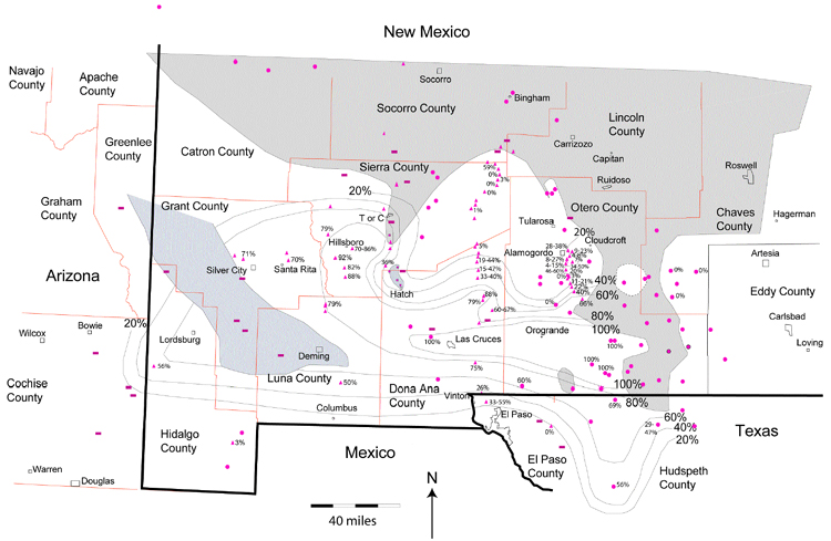
Figure 3. Percent black shale map for south-central and southwestern New Mexico. Data points are provided with a range of values where studies disagree. Contour interval is 20%.
Figure 3. Percent black shale map for south-central and southwestern New Mexico. Data points are provided with a range of values where studies disagree. Contour interval is 20%.