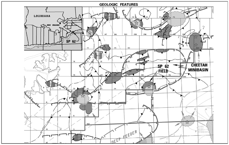
Figure 1. South Pass 62 field is located 50 km southeast of the mouth of the Mississippi River in 100 m of water. Dark gray indicates oil fields. Light gray refers to salt domes or tabular salt.
Figure 1. South Pass 62 field is located 50 km southeast of the mouth of the Mississippi River in 100 m of water. Dark gray indicates oil fields. Light gray refers to salt domes or tabular salt.