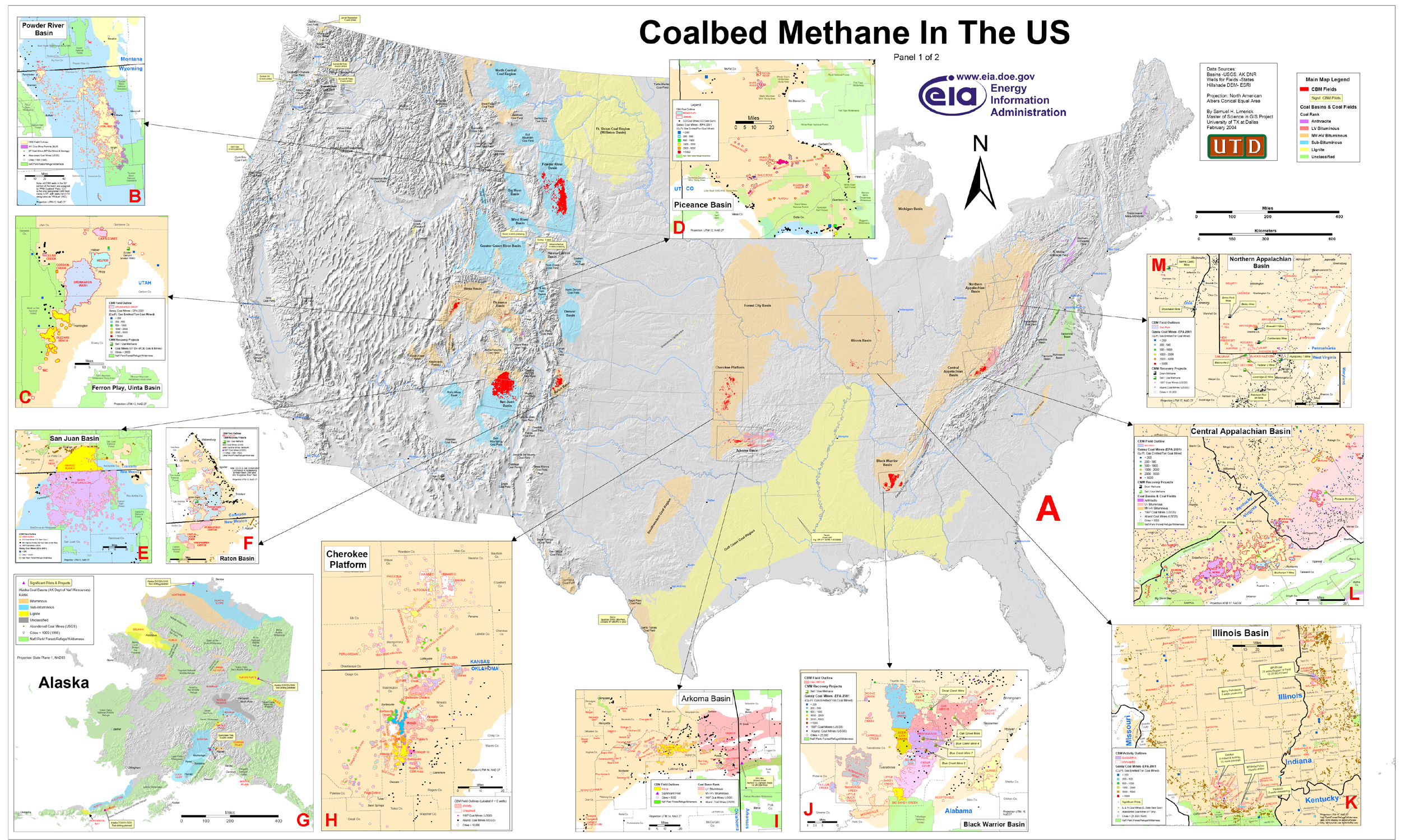
Figure 6.
Coalbed methane in the
United States.
Click on image for overall enlargement.
A. Location map of coalbed methane basins in the southern
48 states and Alaska.
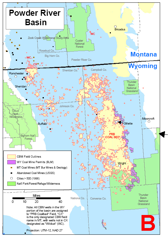
B. Map of coalbed methane fields and coal mine permits, Powder
River Basin, Wyoming and Montana.
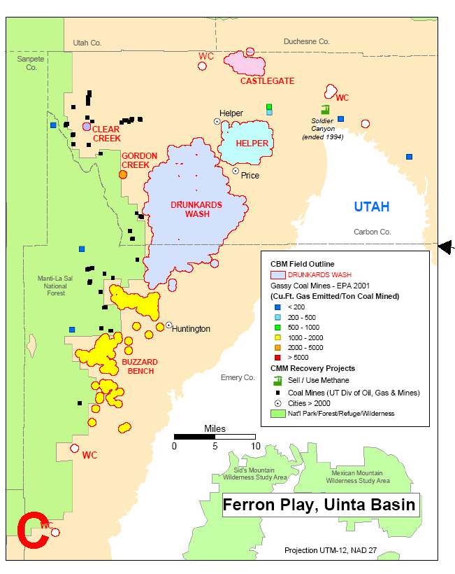
C. Map of Drunkards Wash coalbed methane field and gassy coal
mines, Ferron Play, Uinta basin, Utah.
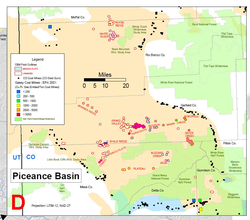
D. Map of coalbed methane fields and gassy coal mines, Piceance
basin, Colorado.
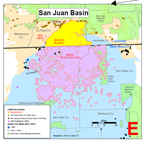
E. Map of coalbed methane field, coal mines, and gassy coal mines,
San Juan basin, Colorado and New Mexico.
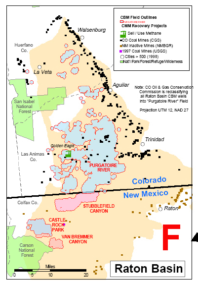
F. Map of coalbed methane fields and coal mines, Raton basin,
Colorado and New Mexico.
G. Map of Alaska coal basins.
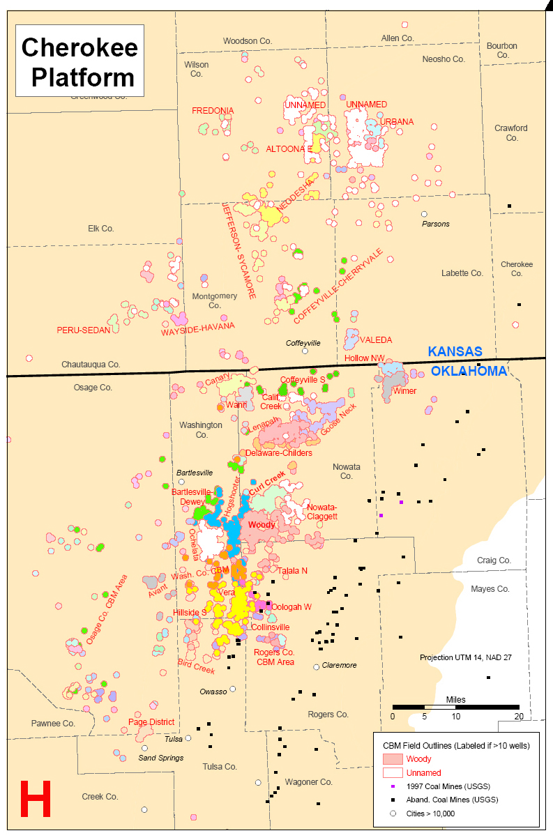
H. Map of coalbed methane fields, Cherokee platform, Oklahoma and
Kansas.
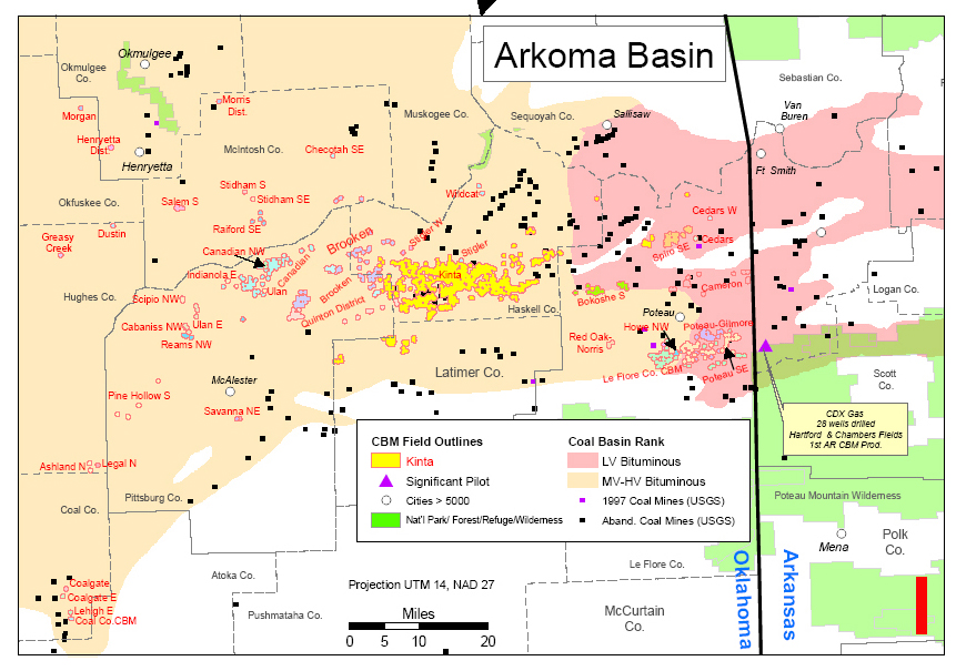
I. Map of coalbed methane fields and coal rank, Arkoma basin,
Oklahoma and Arkansas.
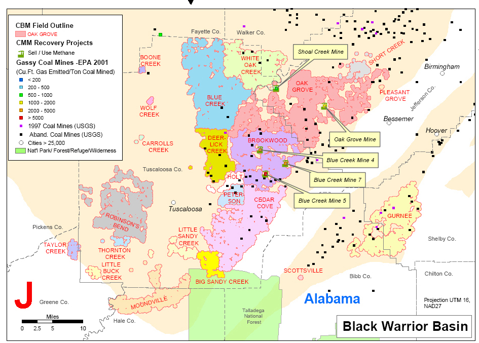
J. Map of coalbed methane field and gassy coal mines, Black
Warrior basin, Alabama.
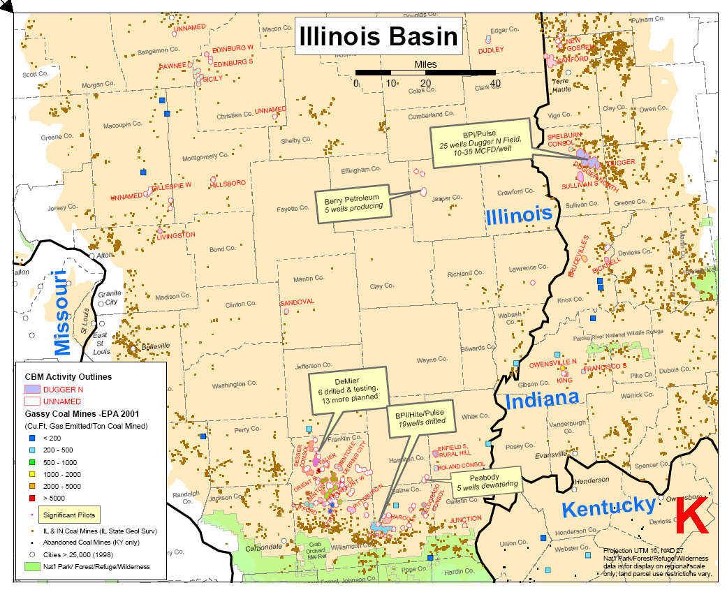
K. Map of areas of coalbed methane activity and gassy coal mines,
Illinois basin.
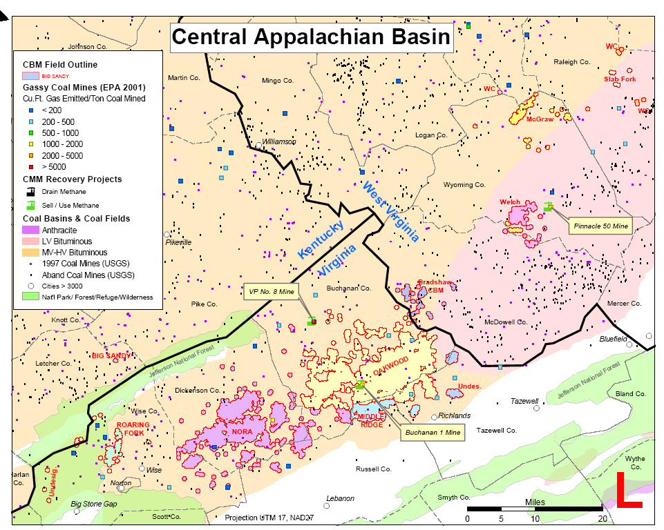
L. Map of coalbed methane fields, gassy coal mines, and coal
basins and fields, Central Appalachian basin.
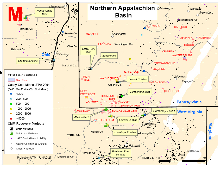
M. Map of coalbed methane fields and gassy coal mines, Northern
Appalachian basin.