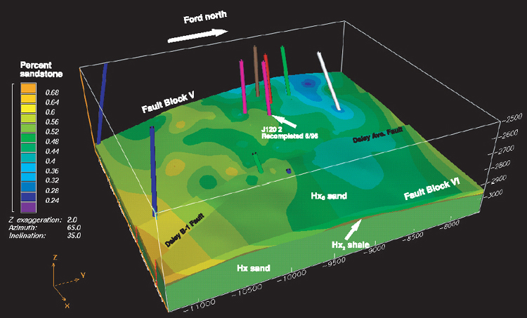
Figure 19. Three-dimensional display of the percentage of sandstone in the Hx0 to Hx2 interval of the Terminal zone in Fault Block V. Cartesian coordinate system is in feet, and vertical exaggeration is 2x.
Figure 19. Three-dimensional display of the percentage of sandstone in the Hx0 to Hx2 interval of the Terminal zone in Fault Block V. Cartesian coordinate system is in feet, and vertical exaggeration is 2x.