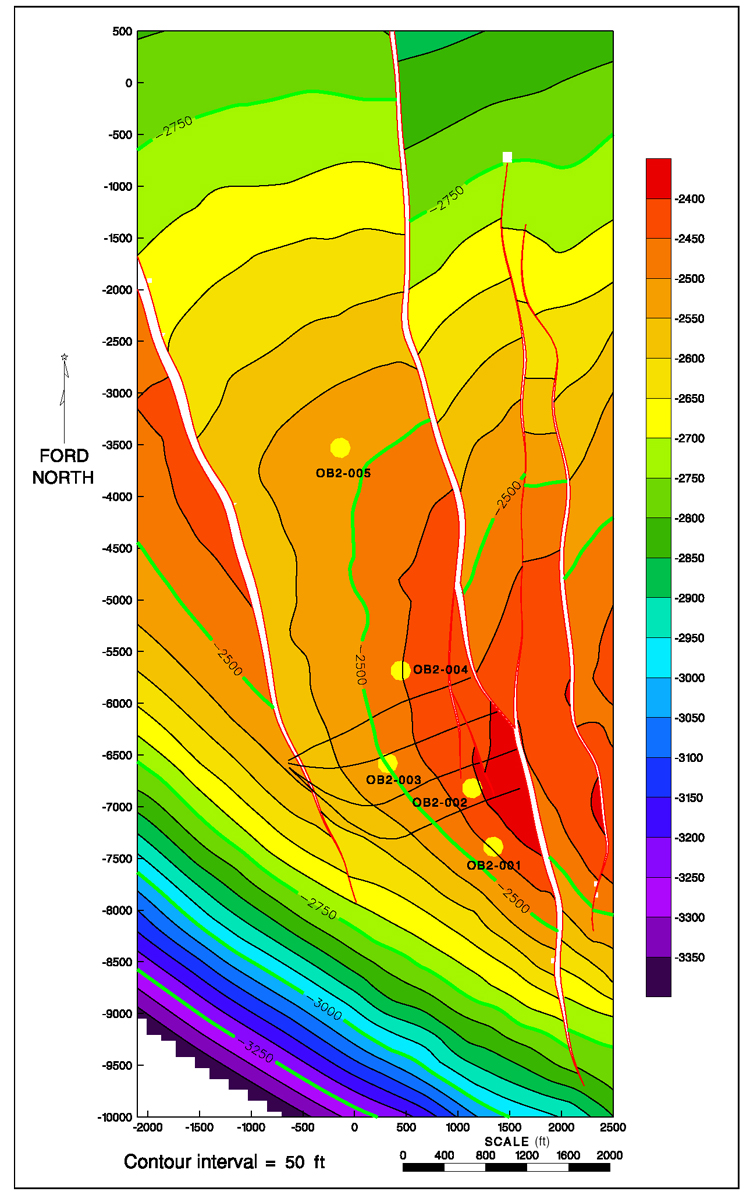
Figure 8. Structure map of the T marker in Fault Block IIA. Observation and horizontal wells are shown. Contour intervals shown are 50 ft (15.2 m) from –2400 to –3400 ft (–731.5 to –1036 m) below sea level.
Figure 8. Structure map of the T marker in Fault Block IIA. Observation and horizontal wells are shown. Contour intervals shown are 50 ft (15.2 m) from –2400 to –3400 ft (–731.5 to –1036 m) below sea level.