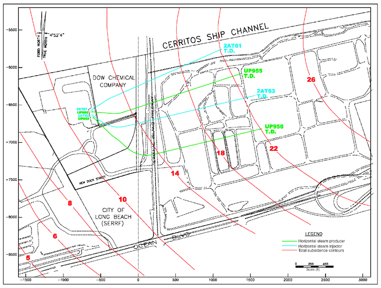
Figure 6. Map showing location of Fault Block II horizontal wells in relation to the subsidence bowl. Red contour lines are total elevation loss in feet. The four horizontal wells were completed in an area of 14 to 22 ft (4.3 to 6.7 m) of subsidence. Producing well courses are shown in blue, and steam-injection well courses are shown in green. The line of cross section A-B parallels well UP 955.