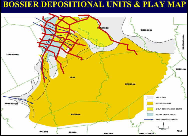
Figure 11. Map of seven county area, East Texas Basin, showing depositional units defining prospective plays in the Bossier Formation and location of well log cross-sections in red) used in this study.
Figure 11. Map of seven county area, East Texas Basin, showing depositional units defining prospective plays in the Bossier Formation and location of well log cross-sections in red) used in this study.