|
uIntroduction
uFigure
captions
uPetroleum
geology
uLateral
seal
uReference
uIntroduction
uFigure
captions
uPetroleum
geology
uLateral
seal
uReference
uIntroduction
uFigure
captions
uPetroleum
geology
uLateral
seal
uReference
uIntroduction
uFigure
captions
uPetroleum
geology
uLateral
seal
uReference
uIntroduction
uFigure
captions
uPetroleum
geology
uLateral
seal
uReference
|
Figure Captions
|
 |
Figure 1.Sudan in the heart of Africa
|
|
 |
Figure 2. Generalized map of
Central Africa showing Central Africa rift system, associated
rift basins, Muglad basin, Sudan, with location of Unity field
(from Giedt, 1990). |
|
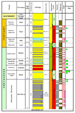 |
Figure 3 General stratigraphic column
- Muglad Basin, Sudan, showing three geological cycles—Neocomian
to Barremian, Aptian to Maestrichtian, and Paleocene to
Pliocene-Miocene, or Quaternary. |
|
 |
Figure 4. Schematic illustration of
lateral seal dependence on the Aradeiba thickness, lithology,
and the amount of fault throw. (a) Footwall block; fault throw
is less than the thickness of Aradeiba  Shale Shale , massive Aradeiba
Shale provides the top and lateral seal for Bentiu reservoir.
Oil column increases with increasing fault throw. Where fault
throw is larger than the thickness of Aradeiba Shale, Bentiu
objective is juxtaposed against Zarqa sand, resulting in lateral
seal failure. (b) Hanging wall fault block; Aradeiba
intraformational shale and fault smear provide the top and
lateral seal for Aradeiba reservoirs; for Bentiu Sand, the
objective is juxtaposed against the Bentiu massive sand across
fault causing lateral seal failure. However, fault smear can
provide weak lateral seal to form a limited oil column. , massive Aradeiba
Shale provides the top and lateral seal for Bentiu reservoir.
Oil column increases with increasing fault throw. Where fault
throw is larger than the thickness of Aradeiba Shale, Bentiu
objective is juxtaposed against Zarqa sand, resulting in lateral
seal failure. (b) Hanging wall fault block; Aradeiba
intraformational shale and fault smear provide the top and
lateral seal for Aradeiba reservoirs; for Bentiu Sand, the
objective is juxtaposed against the Bentiu massive sand across
fault causing lateral seal failure. However, fault smear can
provide weak lateral seal to form a limited oil column. |
|
 |
Figure 5. An excellent fault-sealing
example. (a) The top Bentiu depth map shows a field charged to
structural spill point with 140-m oil column. (b) 3D seismic
section illustrates that the thick massive Aradeiba Shale (480
m) provided good top and lateral seal for Bentiu reservoir. The
fault throw (430 m) is less than the thickness of Aradeiba
Shale. |
|
 |
Figure 6. Another excellent
fault-seal example. (a) Oil column is controlled by the fault
throw in the northern part. (b) The thick (approximately 400 m)
massive Aradeiba Shale provided good top and lateral seal for
Bentiu reservoir. (c) 3D random section illustrates that the oil
column is nearly equal to minimum fault throw (80 m) at which
point sand is juxtaposed sand. |
|
 |
Figure 7. (a) Top Bentiu TWT map shows a tilted footwall fault
block with US-1, water-bearing well, in Bentiu, and USS-1 an oil
discovery well. The throw of the bounding fault varies from 400
m in the north (across US-1) to 300 m in the south (across
USS-1). (b) The section illustrates that the fault throw across
US-1 well is larger than the thickness of Aradeiba shale (360m),
juxtaposing Bentiu reservoir against Zarqa sands, resulting in
lateral leakage; hence, Bentiu sand is water-bearing. (c) The
section illustrates that the fault throw is smaller than
thickness of Aradeiba shale and thereby provides good lateral
seal, resulting in USS-1 discovery (drilled after US-1). |
|
 |
Figure 8. (a) Cross-section showing
water-bearing zones in upper part of Bentiu reservoir, due to
lateral seal failure, and pay zone in lower part (Bentiu III
sand). Bentiu III sand is juxtaposed against Aradeiba Shale
resulting in good lateral seal. Top seal is provided by intra-Bentiu
shale. (b) Cross-section with dry hole, where there is lack of
lateral seal for Bentiu reservoir. These two cross-sections
illustrate lateral-seal risk associated with footwall closures.
Optimum fault throw in comparison with Aradeiba Shale section is
critical for trap integrity. |
|
 |
Figure 9. Example of oil
discovery in a hanging-wall fault block. AA, AB, and AC sands
are production zones with more than 50-m oil columns. AB and AC
sands juxtaposed against Aradeiba intraformational shale across
the fault to provide good lateral seal; AA and Bentiu sand
juxtaposed against AB sand and Bentiu massive sand,
respectively, but shale fault smear provided good lateral seal,
resulting in a small oil column in Bentiu reservoir. |
|
 |
Figure 10. 3D Seismic Section, showing a dry hole in the
hanging-wall fault block. This illustrates why the hanging-wall
closure bounded by fault has high lateral seal risk. Bentiu
reservoir objective is juxtaposed against Bentiu massive sand in
the upthrown block across the fault. |
Return to top.
Muglad Basin contains a thick sequence of
nonmarine sediments, which range in age from Cretaceous to Tertiary. The
basin is A generalized stratigraphic column is shown in
Figure 3,
illustrating the rift and sag episodes in relation to basin filling and
sedimentation.
Exploration results have proved hydrocarbon
system in both Tertiary and Cretaceous sections. The main hydrocarbon
play is the Cretaceous petroleum system. This petroleum system has a
perfect assemblage of source, reservoir, and top seal. The source is the
Lower Cretaceous lacustrine shale of “Abu Gabra” Formation.
The reservoir is the braided-stream sandstones
of “Bentiu” Formation, and the top seal is the fluvial shale of Aradeiba
Formation. More than 70% of traps are tilted fault blocks with high
dependency on the lateral seal across the bounding fault. Therefore, the
above perfect marriage of source, reservoir, and top seal is
counter-acted by a higher risk in the lateral seal. Bentiu Formation
contains a massive thick sand (over 1500 m in some parts) of good
quality reservoir with localized shale interbeds 20-60 m thick.
Lateral seal depends on the thickness and the
lithology of the Aradeiba shale and the amount of fault throw.
Figure 4
is schematic illustration of this relationship. The Aradeiba Formation
is highly variable in thickness and in sand/shale ratio. Thickest
Aradeiba Formation penetration to date is in excess of 1000 m in the
central part of the basin, decreasing to less than 20 m along the basin
edges. Most of the perfect lateral seals are due to direct juxtaposintion of Bentiu sandstone reservoirs against Aradeiba shale.
Examples of this situation are illustrated in Figures
5, 6,
7 and 8.
In some cases clay smear and shale gouge ratio
play an important role in lateral seal integrity. The shale gouge ratio
seems to depend on shale thickness and amount of displacement along the
fault plane. Shale gouge will, of course, also depend on clay
mineralogy, but this aspect has not been fully investigated.
Giedt, Norman,
R., 1990, Unity field—Sudan Muglad rift basin, Upper Nile province,
in AAPG Treatise in Petroleum Geology, Structural traps III:
Tectonic fold and fault traps, p. 177-197.
Return to top.
|