Click image for enlargement.
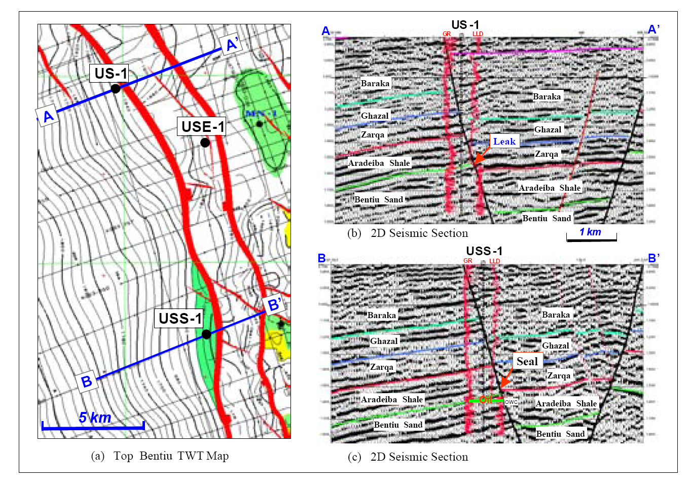
Figure 7. (a) Top Bentiu TWT map shows a tilted footwall fault block with US-1, water-bearing well, in Bentiu, and USS-1 an oil discovery well. The throw of the bounding fault varies from 400 m in the north (across US-1) to 300 m in the south (across USS-1). (b) The section illustrates that the fault throw across US-1 well is larger than the thickness of Aradeiba shale (360m), juxtaposing Bentiu reservoir against Zarqa sands, resulting in lateral leakage; hence, Bentiu sand is water-bearing. (c) The section illustrates that the fault throw is smaller than thickness of Aradeiba shale and thereby provides good lateral seal, resulting in USS-1 discovery (drilled after US-1).