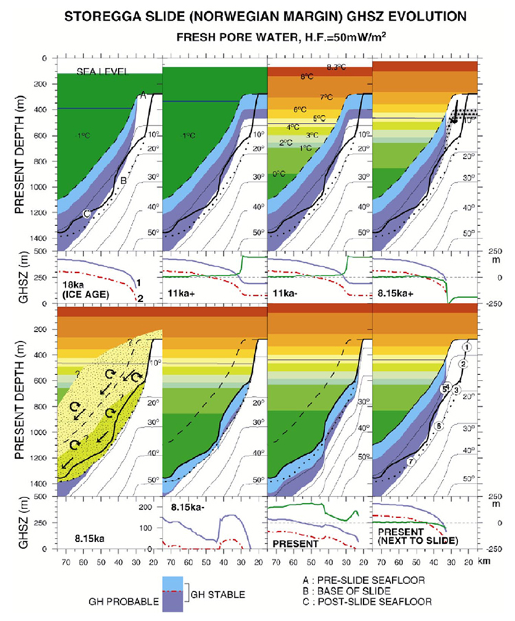
Figure 2. Computed changes in gas hydrate stability zone (GHSZ) over time from last glacial maximum (18,000 years ago, or 18ka) to ocean warming at 11ka, Storegga landslide at 8.15ka, and to present conditions in slide area and on adjacent, not (yet) failed seafloor. 11ka+ means just prior to 11,000 years ago, etc. Stippled zone in 8.15ka+ profile shows area of hydrates dissociated from previous profile (11ka-). Top of each profile is modern sea level. The sub-seafloor GHSZ is shown in blue, with the upper 115m (light blue) probably lacking hydrate. Horizontal blue line is upper limit of GHSZ in ocean. Dashed line (A) shows the restored, pre-slide seafloor, heavy line (B) is the present seafloor, and dotted line (B) is the failure surface (base of slide). Conditions during the actual slide (8.15ka) are schematic only. Small numbers show points whose trajectories in (P, T) space are shown in Figure 3.