![]() Click
to view article in PDF format.
Click
to view article in PDF format.
The Petroleum Potential of the Saba Bank Area, Netherlands Antilles*
By
Richard E. Church1 and Kevin R. Allison2
Search and Discovery Article #10076 (2004)
Posted December 20, 2004
*Adapted from PowerPoint images, accompanied by text, prepared for presentation to interested parties.
1Denver, CO ([email protected])
2Highlands Ranch, CO ([email protected])
Abstract
Saba Bank is a submerged carbonate bank in the northeastern Caribbean Sea, located five kilometers southwest of the northern Lesser Antilles island of Saba. It is approximately 140 kilometers east-southeast of St. Croix, U.S. Virgin Islands. The bank is an elliptical platform 10 to 100 meters below sea level, covering approximately 2200 square kilometers. Saba Bank is part of the Netherlands Antilles, and petroleum activities on the bank are administered by Saba Bank Petroleum Resources, a company jointly owned by the central government of the Netherlands Antilles and the island governments of Saba, Sint Maarten, and Sint Eustatius.
Saba Bank is a backarc basin on the west side of the northern Lesser Antilles, a slowly moving, active margin island arc on the eastern edge of the Caribbean Plate under which Atlantic oceanic crust is being subducted.
Exploration
activities, including the acquisition and interpretation of 4300 kilometers of
![]() seismic
seismic![]() data and the drilling of two wells in the southeastern part of the bank,
have defined a Tertiary basin with over 4000 meters of Recent-Eocene sedimentary
fill in the eastern half of the bank and a western shelf with a thin Tertiary
section underlain by a thick pre-Eocene (Cretaceous?) sedimentary sequence. The
basin and shelf areas are separated by a major wrench fault with associated
flower structures.
data and the drilling of two wells in the southeastern part of the bank,
have defined a Tertiary basin with over 4000 meters of Recent-Eocene sedimentary
fill in the eastern half of the bank and a western shelf with a thin Tertiary
section underlain by a thick pre-Eocene (Cretaceous?) sedimentary sequence. The
basin and shelf areas are separated by a major wrench fault with associated
flower structures.
Saba Bank No. 1 tested a mid-Tertiary reef, 934 meters thick; it contained several porous, permeable intervals, but the only indications of hydrocarbons were minor gas shows. Saba Bank No. 2, on a high deeper in the basin, encountered a turbidite/deepwater fan sequence, instead of the reef. Minor gas shows during drilling and log interpretation indicated the presence of possible gas-bearing reservoirs. Geochemical studies suggest that the hydrocarbons represent migrated hydrocarbon generated from deeper, more mature source rock.
A large four-way dip closed prospect with the potential for substantial hydrocarbon reserves has been developed on the untested western shelf area of Saba Bank.
|
|
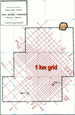
Saba Bank is a shallow-water submerged carbonate bank in the northeast Caribbean Sea five kilometers southwest of the northern Lesser Antilles island of Saba (Figures 1 and 2). It is approximately 140 kilometers east-southeast of St. Croix, U.S. Virgin Islands. As defined on published bathymetric charts, Saba Bank is a submerged elliptical platform, 10 to 100 meters below sea level, that covers approximately 2200 square kilometers (Figure 3). It is about 1000 meters above the sea floor in the vicinity of Saba Island, the only landmass in the immediate area, and is separated from the island by a 700-meter deep trough. The Saba Bank area is part of the Netherlands Antilles, an autonomous part of the Kingdom of the Netherlands consisting of the Caribbean islands of Bonaire, Curacao, Saba, Sint Maarten and Sint Eustatius. Petroleum activities are administered by Saba Bank Resources N.V., a company jointly owned by the central government of the Netherlands Antilles located on Curacao and the island governments of Saba, Sint Maarten, and Sint Eustatius. For petroleum exploration licensing purposes the Saba Bank Area is divided into forty-three 7’30” x 3’45” blocks.
The
presence of a relatively large shallow-water area in a geologically
interesting and unexplored region led to at least eleven In
December, 1974, Weeks signed an agreement with the Netherlands Antilles
Government, which granted Weeks an exclusive In
December, 1976, the Netherlands Antilles Government enacted a new
petroleum law, which created Saba Bank Resources N.V., with the rights
to explore and produce petroleum on the Saba Bank. A production sharing
agreement The Marathon group spudded Saba Bank No. 1 (SB-1) (Figures 4, 5, and 6), the first exploratory well in the Saba Bank area, on April 6, 1977. The well was abandoned as a dry hole with minor gas shows on June 21, 1977, after reaching a total depth of 2974.7 meters. No further exploration was done, and the production sharing contract was terminated at the end of April, 1978. On July
1, 1979, Saba Bank Resources N.V. granted Weeks Natural Resources an
exclusive option to acquire nine contiguous blocks with an obligation to
conduct a In
January, 1988, Saba Bank Resources N.V. granted Aladdin Petroleum
Corporation an option to acquire 14 contiguous blocks with an obligation
to conduct a detailed During
December, 1999, Western Geophysical acquired 205 kilometers of 120-fold
infill
The
presently available Well data for SB-1 SB-2 include wireline log suites, mud logs, and operational reports, as well as various in-house and consulting reports analyzing and interpreting the biostratigraphy and geochemistry of the sediments encountered. Several consultants' reports and accompanying maps describing the prospectivity of the block are also available.
Geologic Setting
Saba Bank is a backarc basin on the west side of the northern Lesser Antilles, a slowly moving, active margin island arc on the eastern edge of the Caribbean plate under which Atlantic oceanic crust is being subducted at a rate of about 2.2 centimeters per year. The present northern Lesser Antilles are formed by a double volcanic arc that coalesces to the south near Martinique (Figures 1, 10, and 11) to form a single row of islands in the southern Lesser Antilles. The islands and islets of the outer arc, often referred to as the "Limestone Caribbees", are composed of middle Eocene to Oligocene volcanics and questionable Miocene intrusives capped with middle Eocene to Pleistocene carbonates (Maury et al, 1990). There are no Neogene volcanic centers in the outer arc. The northern inner arc, often referred to as the "Volcanic Caribbees", is made up of young volcanic islands, including Saba Island, in which volcanism was initiated during latest Miocene or Pliocene and continues today (Figure 11), and by an extinct volcanic ridge extending 120 kilometers northward from Saba Island to the Anegada passage (Figure 1). The two arcs are separated by an intra-arc trough, the Kallinago Depression, which extends from north of Guadeloupe to the Anegada Passage. It varies in depth from 600 meters to about 2000 meters at its north end. The forearc complex of the northern Lesser Antilles near Saba Bank is much narrower than farther south. Fina's
SB-2 encountered nearly 4000 meters of middle Eocene to Recent sediments
overlying Eocene andesite. The andesite is approximately the same age as
the earliest volcanics identified in the Lesser Antilles outer arc to
the northeast. The Tertiary sediments were deposited in a highly
asymmetric backarc basin resembling a half graben with the eastern steep
basin flank controlled by a large down-to-the-west fault system just
west of St. Eustatius.
In order to develop a coherent geologic model for Saba Bank it is necessary to examine the geologic history of the northern Lesser Antilles within the framework of the tectonic development of the Caribbean Plate. Within the last decade a number of syntheses for the plate tectonic history of the Caribbean have been published. While there remain numerous unresolved details, there appears to be general agreement among the leading researchers for a plate history involving a single Great Caribbean island arc system (Burke, 1988), also referred to as a continuous Mesozoic Arc (Bouysse, 1988), which was initiated in the Pacific during Cretaceous time and migrated into the Atlantic. The
Caribbean did not exist prior to the Late Triassic-Jurassic breakup of
the Pangean supercontinent. By Early Cretaceous time a Proto-Caribbean
Ocean had developed with oceanic crust being created along
northeast-trending spreading axes as North America, South America and
Africa drifted apart. A Proto-Greater Antilles island arc formed in the
Pacific Ocean at the eastern edge of the Farallon plate subduction zone
in the widening gap Today
the Lesser Antilles remains a slowly moving active margin island arc on
the eastern edge of the Caribbean plate (Figure
11). Because of the low
rate of convergence, volcanism and Within the framework of the overall plate tectonic history, the Lesser Antilles have experienced a complex history which is not well understood, but they have probably been part of an active volcanic arc since Early Cretaceous time (Bouysse, 1988). Their pre-middle Eocene history is not well known because of lack of outcrops. The oldest known rocks are uppermost Jurassic to Lower Cretaceous volcanics reported from La Desirade Island; they may represent early stages in the development of the Great Arc. Upper Cretaceous volcanics have been dredged from the midslope of the Anguilla and Antigua platforms and Cretaceous granodiorite and volcanic fragments have been dredged from the Aves Swell. Other pre-middle Eocene data are limited, but the Lesser Antilles were probably part of an arc system that included what is now the Aves Swell as well as the Greater Antilles until mid-Eocene time when the Grenada basin formed and left the Aves Swell as an inactive remnant arc west of the Cenozoic Lesser Antilles volcanic island arc. At about the same time the Lesser Antilles volcanic arc was separated from the Greater Antilles arc. As noted earlier, the present northern Lesser Antilles are a double volcanic arc composed of an inactive Eocene-Oligocene outer arc formed by the islands and islets of Marie-Galante, Grande-Terre of Guadeloupe, Antigua, St. Barthelemy, St. Maarten, Tintamarre, Anguilla, Dog and Sombrero, and an active Neogene inner arc consisting of the islands of Dominica, les Saintes, Basse-Terre of Guadeloupe, Montserrat, Redonda, Nevis, St. Kitts, St. Eustatius, and Saba. It has been suggested that this westward shift of magmatism to the northern Volcanic Caribbees during the latest Miocene or Pliocene was induced by the subduction of ridges that flank old transform faults in the Atlantic oceanic crust (Bouysse, 1984; Westbrook and McCann, 1986). This may have produced a flattening of the angle of subduction of the lithosphere because of the buoyant effect of the ridges, or a narrowing of the forearc by displacement/erosion of part of the forearc by the ridges.
Saba
Bank presently is a backarc basin on the west side of the active
northern Volcanic Caribbes island arc platform. Data from SB-1 and SB-2
along with records from several
Late CretaceousAs noted in the section of plate tectonic history, Jurassic to Lower Cretaceous volcanic units have been identified on La Deseride Island, and Upper Cretaceous volcanic rocks have been dredged from steep escarpments located east of Antigua, Barbuda and Anguilla, and from the Aves Swell. They strongly suggest that both the northern Lesser Antilles and the Aves Swell were part of a Mesozoic volcanic island arc that was initiated in the Pacific and was intruding into the Caribbean by Late Cretaceous time (Figure 10). The southern Lesser Antilles volcanic arc may not have existed prior to the Eocene so that by Late Cretaceous time the northern Lesser Antilles-Aves Ridge volcanic arc was impinging on the northwest margin of South America (Figure 10). While
the stratigraphic evidence necessary to define the paleogeography of
Saba Bank during Late Cretaceous time is sparse, scattered dredge hauls
suggest extensive shallow-water platform areas were present within the
volcanic island arc. Dredging along the northern slope of the Anguilla
platform during the French Arcante 3 cruise recovered volcanic tuffs and
marls from depths St. Croix Island, 150 kilometers to the west-northwest of Saba Bank, has over 10,000 meters of strongly deformed Upper Cretaceous deepwater calcareous turbidites and volcaniclastics. They were deposited in a deep-water basin from a northerly volcanic arc source and appear to be unrelated to Upper Cretaceous sediments of the Aves Swell/Lesser Antilles island arc. Analyses of kerogens in SB-1 by Marathon revealed considerable reworked Cretaceous coaly material in the upper Eocene-middle Miocene volcaniclastic sequence. The character of the material indicates it was sourced from an exposed Cretaceous deltaic source that had undergone considerably less deformation than the St. Croix section. Robertson Research reported reworked Cretaceous calcareous nannofossils from the equivalent, but deeper water section in SB-2. The relationship of Saba Bank -1 and SB-2 suggests the Late Cretaceous sediment source was to the west or northwest of the wells.
PaleoceneThe
only known outcrop of Paleocene rocks in the Lesser Antilles is on
Anguilla island where uppermost Danian to Thanetian pelagic marly
limestones and black shales completely devoid of volcanic elements crop
out at Crocus Bay. They indicate that a pause in volcanic activity
occurred approximately Dredge hauls east of Grande-Terre de Guadeloupe and west of Sombrero Island recovered Paleocene to Eocene platform limestones and shallow-marine limestone and greywacke, respectively. DSDP holes 30 and 148 drilled on the Aves Swell recovered reworked Paleocene microfauna. Reworked Paleocene spores were also found in a sidewall sample from 2795 meters in SB-1. With no apparent volcanic activity during the Paleocene and only the very limited geologic data described above we can only speculate that the Aves Swell/Lesser Antilles area was a dormant island arc magmatic platform with eroding island landmasses surrounded by inter-island carbonate platforms and deeper basins. Plate II is a representation of what the paleogeography of Saba Bank and the northern Lesser Antilles may have been like during the late Paleocene . Middle-Late EoceneOutcrops on the islands of the Limestone Caribbees, extensive dredge hauls, and the results of SB-1 and SB-2 provide considerably more data from middle Eocene and younger rocks than is available for the older section. During middle and late Eocene time most of Saba Bank area was located on a backarc carbonate platform. The southeastern part of the bank was in deeper water of the northern end of the backarc Grenada Basin. Dredge hauls from the Aves Swell indicate Saba Bank formed part of what was a much more extensive shallow-marine backarc platform or series of inter-island platforms developed on the flanks of and over the tops of the extinct Cretaceous volcanic islands, perhaps similarly to those presently surrounding the Limestone Caribbees. By early Eocene time volcanic activity had been initiated in the Lesser Antilles outer volcanic island arc well to the east of Saba Bank at St. Maarten Island, and by the middle Eocene, St. Barthelemy Island was also the site of shallow submarine volcanism. Volcanic activity appears to have increased during the late Eocene with Anguilla, Dog, and Sombrero Islands probably also sites of active volcanism. SB-1 encountered a thick mid- to late Eocene reefal carbonate unit that grew on a shallow-marine carbonate shelf. SB-2, drilled to the east-northeast off the shelf edge, encountered neritic to bathyal slope submarine sands, pelagic shales, and fine-grained turbidites in the equivalent section. They were deposited in the northernmost part of the Grenada Basin. The carbonate and clastic sections can be correlated to the middle part of the Point-Blanche Formation on St. Maarten.
OligoceneVolcanic activity continued in the Lesser Antilles outer arc during early Oligocene time. St. Maarten, St. Barthelemy, and Antigua were all sites of volcanism in the northern Lesser Antilles, and Martinique and the Grenadines were active in the southern Lesser Antilles. Volcanism ceased in the northern Lesser Antilles in mid-Oligocene time (30 Ma) and did not resume until the late Miocene (10 Ma) when it shifted to the Inner Arc. A volcaniclastic section was deposited in the eastern Saba Bank area in an inner shelf to upper slope environment. The sands and silts encountered in both SB-1 and SB-2 form an eastward prograding fluvial deltaic sequence containing significant quantities of volcanoclastic material. At SB-2, turbidites were initially deposited in a fore-reef trough which the fluvial deltaic system eventually prograded across. The previously noted reworked Cretaceous coaly material in both SB-1 and SB-2, and reworked Paleocene spores in SB-1 indicate erosion of exposed older rocks to the west or northwest of the wells, possibly from the western part of Saba Bank and adjacent areas. Other than Oligocene corals and limestones recovered in a dredge haul southeast of Aves Island, there are very little Oligocene data available for Aves Swell. It was the site of extensive late Eocene and early Miocene shallow-marine carbonate platform deposition, and there is no reason to believe that conditions were any different during the intervening Oligocene.
Early MioceneThere is no evidence of volcanic activity in the northern Lesser Antilles outer arc during early Miocene time, but volcanism continued in Martinique and other islands in the southern part of the arc. Dredging results on the northern outer arc magmatic platform indicate deeper water conditions, with pelagic marls and tuffs being widely deposited. Shallow-water carbonates may have been developed on the platforms of the dormant volcanoes. Deposition of the fluvial deltaic volcaniclastic sequence continued on the eastern Saba Bank, while erosion of older sediments probably continued on the western part of the bank and adjoining areas to the west or northwest. Dredging results indicate shallow to open marine carbonate deposition continued on the Aves Swell.
Late Miocene-PlioceneThe
inner volcanic arc of the northern Lesser Antilles developed during late
Miocene-Pliocene, and parts of it have remained active during historic
time. An intra-arc basin, the Kallinago Depression, developed to the
east of the northern volcanic arc, The westward tilting was also responsible for subsidence of the Saba Bank and adjacent areas that had been a source of clastic sediments during the Oligocene and early Miocene. Saba Bank became the site of carbonate deposition that kept pace with the rate of subsidence so that it remained a shallow-water carbonate platform while deeper water pelagic clays, mudstones and calcareous oozes were deposited on the Aves Swell. Large
shallow-marine carbonate platforms developed on the northern Lesser
Antilles magmatic arc around the extinct volcanoes, which probably
provided limited sources for volcaniclastic sediments. Deeper water
pelagic marls and tuffaceous marls were deposited in the interplatform
area and
Saba Bank is a highly asymmetric backarc basin on the west side of the slowly moving Lesser Antilles island arc. It is essentially a half graben with the eastern steep basin flank controlled by a large down-to-the-west normal fault system just west of St Eustatius (Figure 1). A
major northeast-trending, down-to-the-southeast fault divides Saba Bank
into a western platform area characterized by a thin Tertiary section
unconformably overlying a thick pre-Eocene (Cretaceous?) sequence and an
eastern area with a thick Tertiary sedimentary section overlying Eocene
volcanics and an older (Cretaceous?) sequence (see
Figure 24). The
Tertiary section in the eastern area thickens to the southeast into the Genada Trough. Reworked Late Cretaceous kerogen in SB-1 indicates the
down-to-the southeast fault has been active since at least late Eocene
time. Interpretation of the
Angular unconformities seen on the reprocessed The structure of the eastern Tertiary basin fill is typical of a subsiding shelf-shelf edge trough with numerous down-to-the-basin and antithetic normal faults. The structure of the pre-Eocene is obscured by its greater depth and the presence of a volcanic section, but the reprocessed data indicate extensive half grabens and tilted fault blocks are present in what appears to be a continuation of the thick pre-Eocene section to the west.
SB-1 and SB-2 encountered a thick Tertiary sedimentary section composed of carbonate and clastic sequences with some pyroclastic intercalations resting on porphyritic andesite. In each of the wells the section overlying the andesites has been divided into three major stratigraphic units (Figures 12, 13, 14, 15, 16, and 17). They are: an Upper Carbonate Unit, a Fluvio-Deltaic (Fina) or Volcaniclastic Unit (Marathon), and a Lower Carbonate Unit in SB-1 and its Channel-Turbidite Unit equivalent in SB-2.
Analyses of The stratigraphy of the post-volcanic units has been summarized by Robertson Research (1984), a summary of which is presented below.
Upper Carbonate Unit (e.g., Figures 14, 16) The uppermost unit encountered in SB-1 is an 1110-meter carbonate sequence composed of translucent to pale yellow, crystalline to micro- crystalline limestones with sugary texture, and white bioclatic limestone with micritic cement. The lower portion of the unit is more argillaceous and contains cryptocrystalline light green limestones and light brown, hard, brittle microcrystalline sucrosic dolomites. Fossils are abundant throughout the unit with numerous shell and coral fragments, algae, and foraminifera. Porosity generally varies from 10 - 25 percent. SB-2
well encountered a thicker Upper Carbonate Unit (1429 meters) with
similar Planktonic foraminifera give a middle Miocene to early Pliocene age for the Upper Carbonate Unit. The fossil data indicate deposition at shallow depths within a reef complex that was dominated by lithothaminoid algae throughout most of its development. The Upper Carbonate Unit is at least in part equivalent to the Kingshill Limestone that crops out on St. Croix Island and is similar to limestones of the same age exposed on St. Maarten, St. Barthelemy, and Anguilla Islands.
Fluvial-Deltaic Unit (Volcaniclastic Middle Series) (e.g., Figures 14, 16) SB-1 encountered a 755-meter clastic sequence immediately beneath the Upper Carbonate Unit. It consists primarily of interbedded siltstones, claystones, and tuffaceous, very fine grained to silty sandstones with conglomerates and rare thin marine limestones. Marathon referred to this sequence as the Volcaniclastic Series. The sandstones and some conglomerates have fair to excellent porosity. Foraminiferal assemblages indicate an inner shelf environment down to a depth of 1554 meters. The
interval SB-2 encountered a 1486-meter sequence of fluvial-deltaic sediments beneath the Upper Carbonate Unit, which Fina named the Fluvial-Delta Sequence. Robertson Research (1984) has divided the unit into two sections as follows: The Upper Section (1480-2256 meters) is mainly composed of dark green, firm claystones grading to pale green, slightly calcareous siltstones, with some beds of white silty limestones and red to brown claystones, in the upper part. The unit becomes increasingly sandy with depth. Microfossils are rare at the top of the interval where very poor assemblages of benthonic rotalid foraminifera occur. Below 1770 meters Miogypsina, Elphidium,and a few ostracods are recognized. The unit ranges in age from late Oligocene to early Miocene. The sediments were deposited in an inner neritic environment. On the
basis of log correlation, In the
Lower Section (2256-2967 meters), the A middle to late Oligocene age has been assigned to this section based mainly on good calcareous nannofossil assemblages. Benthonic foraminifera indicate an open marine, probably middle neritic environment was predominant, but the intermittent occurrence of nannofossils also suggests fluctuating conditions. This sequence in SB-2 is tentatively correlated with the section of interbedded claystones and tuffaceous, very fine grained to silty sandstones encountered in SB-1 from 1556-1685 meters, where slightly shallower inner to middle neritic conditions are indicated.
Lower Carbonate Unit (Figure 14)SB-1 encountered a thick carbonate unit beneath the Volcaniclastic Series (at 1922 meters), which Marathon referred to as the Lower Carbonate Unit. Labofina S.A. describes the 934-meter Lower Carbonate Unit as alternations of micritic to microsparitic limestone, dense to slightly porous, containing bioclasts; biomicrites and biosparites to biomicrosparites, locally recrystallized, having very good vuggy and intergranular porosity; and thin clayey laminations. Poorly sorted, bioclastic fractions composed mainly of very abundant debris of encrusting coralline algae do not exceed 50%. Large sized bioclastic debris is mainly coral encrusted by coralline algae, which are abundant and present everywhere in this unit. Less numerous are echinoderm debris, echinoid spines, pelecypods, microgastropods, ostracods, and foraminifera. Study of conventional core material, sidewall cores and wireline logs indicate substantial intervals of porous and permeable rock with porosities from 11 to 25%. The Lower Carbonate unit is separated from the underlying volcanic sequence by a 12-meter weathered zone of undetermined age. Based on the predominant larger benthonic foraminifera assemblages, the age of the Lower Carbonate Unit was determined to be middle to late Eocene and is partially time-equivalent to a silty section drilled in SB-2 from 3367 to 4032 meters. A shallow, shelf marine environment is indicated for the Lower Carbonate Unit. The presence of reef building organisms such as coralline algae and corals, associated with large benthic foraminifera, indicates a reef facies. However, the common presence in cores of algal grains rather than large crusting or branching colonies may suggest a back reef shelf environment.
Channel-Turbidite Unit (Figure 16)SB-2 did not encounter the Lower Carbonate Unit beneath the Fluvial-Delta unit as expected, but instead penetrated a 1065-meter clastic unit which Fina termed the Turbidite Sequence and which Robertson Research has named the Channel-Turbidite Unit. They divided it into two sections as follows: The Upper Section (2967-3367 meters) of the Channel-Turbidite Unit is a thick series of siltstones, claystones, and clayey siltstones. An age from late Eocene to early Oligocene has been assigned this section even though the position of the Oligocene/Eocene boundary cannot be precisely defined. In
SB-1, a late Eocene to early Oligocene age has also been assigned to the
interval The
Lower Section (3367-4032 meters) is primarily a sequence of silty
claystones and argillaceous siltstones. Several sandstones with low to
moderate porosity were reported Sedimentological evidence from cores at 3421-3428 and 3786-3795 meters strongly suggests the presence of an outer submarine fan sequence with pelagic shales and fine-grained turbidites. The sandstones and siltstones are usually graded. Planktonic foraminifera and calcareous nannofossils date the unit as not older than late Eocene. Foraminiferal faunas indicate deposition in an outer neritic to bathyal slope environment. The top of this section in SB-2 is considered the time equivalent of the top of the Lower Carbonate sequence in SB-1. The base of the unit is separated from the volcanic unit by a 57-meter interval of either weathered volcanic rock or sedimentary rocks containing abundant volcanic fragments. According to Robertson Research, the lower section of the Channel-Turbidite Unit and the SB-1 Lower Carbonate Unit can be correlated with the upper Eocene Point-Blanche Formation that is exposed on St. Maarten Island.
Volcanic Unit (Figures 14, 16)SB-1 encountered a volcanic unit from 2856 to 2975 meters (T.D.). As described from a conventional core at the base of the drilled section, the rock is a gray-green andesite porphyritic unit with dark green millimetric phenocrysts, euhedral to subhedral hornblende and indistinct white battens of plagioclases, coated in a microlitic goundmass composed primarily of plagioclases. Streaks of hematite and small millimetric accumulations of pyrite are scattered in the rock. Potassium/Argon radiometric dating of hornblende by Geochron USA for Marathon dated the andesite encountered at 2865 meters in SB-1 as 64.5 Ma, or earliest Paleocene. SB-2
also penetrated an andesite. The top of the unit is somewhat ambiguous,
but Fina picked it at 4032 meters on a velocity increase on the sonic
log. However, gamma ray readings increase sharply at 3974 meters and
remain high to 4032 meters. The
Marathon interpreted the andesite in SB-1 as a near surface intrusion
and/or part of a volcanic feeder system. Neither well penetrated the
base of the andesite, but
Pre-Volcanic Sequence (Figures 14, 16, and 17)The age of the pre-volcanic sequence is uncertain. Marathon dated the andesite encountered at 2865 meters in SB-1 as earliest Paleocene. The radiometric analyses Fina had done on both the SB-1 and SB-2 andesites dates both rock units as late Eocene. If the age dating done for Fina is correct, the pre-volcanic section could consist of Paleocene to middle Eocene age sediments overlying Upper Cretaceous and older sediments. During the Late Cretaceous, Saba Bank is thought to have occupied a backarc position on the Aves Swell volcanic arc that was part of the Greater Antilles volcanic arc that also included Cuba, Hispanola, Puerto Rico, and St. Croix Island. As noted earlier, scattered dredge hauls over the Aves Swell suggest extensive shallow-water platform areas were present during the Late Cretaceous. St. Croix Island has over 10,000 meters of strongly deformed Upper Cretaceous calcareous turbidites and volcaniclastics that were deposited in a deep-water basin and appear to be unrelated to the Upper Cretaceous sediments of the Aves Swell. Puerto Rico also has thick sequences of Cretaceous and Early Tertiary volcanic, volcaniclastic and calcareous rocks. The strata include shales, sandstones, and rare limestones deposited as turbidites, shelf sediments, and reefs, suggesting the magmatic arc platform was topographically complex. Analyses of kerogens in SB-1 by Marathon revealed considerable reworked Cretaceous coaly material in the upper Eocene-middle Miocene volcaniclasitic sequence. The character of the material indicates it was sourced from exposed deltaic sediments. Thermal maturation indices within the oil window indicate the deltaic rocks have undergone considerably less deformation than the St. Croix sequence. Marathon biostratigraphic studies also report the presence of reworked Cretaceous fossils in the Tertiary volcaniclastic section, and Robertson Research found similar reworked Cretaceous fossils in SB-2. The relationship of the two wells along with dipmeter data from SB-2 indicate the exposed Cretaceous deltaic sequence supplying sediments to the volcaniclastic sequence was located to the west or northwest of the wells, possibly in the western Saba Bank platform area. The sediment source for the indicated Cretaceous deltaic sediments may have been the southern Yucatan block with which the Greater Antilles arc collided during Late Cretaceous time (Figure 10). It is possible that the Saba Bank pre-volcanic sequence also contains Paleocene sediments. Reworked Paleocene spores were found in a sidewall sample from 2795 meters in SB-1. Bouysse (1988) reports the presence of Paleocene (uppermost Danian to Thantian) pelagic marly limestones and black shales completely devoid of volcanics on Anguilla Island. As noted in the section on paleogeography, dredge hauls in the Lesser Antilles have recovered Paleocene shallow-marine limestone and greywacke while DSDP holes 30 and 148 drilled on the Aves Swell recovered reworked Paleocene microfauna. Because of the probable exposure of Cretaceous sediments to the west, Paleocene sediments, if present, would probably be limited to the eastern part of Saba Bank.
Petroleum GeologyFigure Captions (18-22) and Table 1 CaptionWell ResultsSB-1SB-1
was drilled by Marathon and partners on the southeast part of the Saba
Bank to test the hydrocarbon potential of a well defined The
reef section contains several intervals of porous and permeable
carbonates with porosities in the 20-25% range, but the only indications
of hydrocarbons are minor gas shows Kerogen analyses indicate the thermal maturity of the penetrated section is low. Data indicate that samples near the bottom of the well are approaching the oil generation zone, but are not thermally mature enough for generation.
SB-2The
presence of what were thought to be good, but immature source rocks in
SB-1, along with good reservoir intervals within the Lower Carbonate
Unit suggested that a carbonate buildup located deeper in the basin
within the oil window would likely contain producible hydrocarbons. This
led the Fina group to drill SB-2 on a relatively well defined SB-2 was spudded on February 22, 1982, and was plugged and abandoned as a dry hole on May 25, 1982, at a total depth of 4231 meters. As expected, the well did penetrate a sequence of Pliocene to Eocene age sediments overlying what has been dated as late Eocene andesite; however the objective carbonate facies were not present. The Lower Carbonate Unit facies equivalent penetrated by SB-2 is a series of claystones, argillaceous siltstones to silty claystones with subordinate sandstones having low to moderate log porosity. The unit has been interpreted by Robertson Research as a turbidite/deep sea fan sequence. No
significant hydrocarbon shows were encountered while drilling. Minor gas
shows were encountered in sandstones and siltstones
Source Rock Potential and Geochemistry (Figures 19-22) Geochemistry of SB-1In 1977
Marathon Oil's Denver Research Center made geochemical analyses on nine
composite samples from SB-1 Although TOC values were generally low, bitumen extracts yielded total hydrocarbons of 239-593 ppm. As no evidence for contamination by mud additives such as crude or diesel oil was found, Marathon interpreted these data as indicating that good, but immature oil source rocks occur in both mudstones and carbonates in a sequence at around 2840 meters (composite sample 8) on the basis of higher total organic carbon (1.3%) and 593 ppm hydrocarbons. They note that the hydrocarbons appear to be immature, based on hydrocarbon distributions seen in gas chromatographs of the saturate hydrocarbon fractions. Shallower samples were also reported as potentially good source rocks on the basis of total hydrocarbons although TOC values were low. Robertson Research's interpretation of these data (1984) is that not enough analyses were done to give an accurate assessment of the hydrocarbon-generating potential of the penetrated section. On the basis of the data that are available, they believe that most, if not all, of the extractable hydrocarbons in the samples represent migrated hydrocarbons and not indigenous material. Yields and composition of source rock extracts from Robertson Research's 1984 report are given in Table 1. Organic richness is very low in most samples and conventional assessment of source bed quality based on organic richness (TOC) would classify most of the samples as nonsource (<0.5% TOC) to marginal (0.5-1.0% TOC) sources. They rate one interval (2453-2600 meters) with 1.3% organic carbon as good source. Rock-Eval pyrolysis data presented by Robertson Research have very low hydrogen indices for the tested samples and suggest they are gas prone. Kerogen maturation studies by Marathon based on spore and cuticle coloration indicate the thermal maturity of the penetrated section is low. The data indicate that the samples near the bottom of the well are approaching the oil generation zone, but are not thermally mature enough for generation to have occurred. During the course of the kerogen maturation evaluations, Marathon noted older reworked organic material in several samples. A sidewall core at 1679 meters contained much fungal material and many pieces of light brown cuticle with a color indicating thermal maturity (Ro=0.8%), as well as fusinite and wood fragments. G. K. Guennel, who conducted the study, stated that he considered this material to be reworked from older, more mature rocks, probably from a Cretaceous coal seam. He noted similar, but not as abundant, material in a sidewall core at 1538 meters. A ditch sample from 2390-2399 meters also contained abundant fungal material, wood, and fusinite along with a suite of medium brown Mesozoic spores (Ro=1.0%), probably associated with the fungal material. Guennel again suggested a Cretaceous coal or lignite might have been one of the sources for some of the organic material in this sample. Ditch samples from 2582-2591 and 2737-2246 meters also contain similar reworked fungal and coaly material. In summary, the geochemical data from SB-1 indicate that significant quantities of extractable hydrocarbons are present in the samples throughout the entire sedimentary section. However, the low TOC values and low maturity (<0.6% Ro equivalent) of these samples strongly suggest that the hydrocarbons present are migrated rather than indigenous. The implication is that, although SB-1 probably does not contain good, mature source rocks, there is a good possibility of more deeply buried, thermally mature petroleum source rock facies in the area.
Geochemistry of SB-2Geochemical studies on cuttings, sidewall, and conventional cores from SB-2 were conducted by both Labofina in Brussels (82 samples) and Robertson Research in Houston (12 samples) in order to determine TOC, thermal maturity, and source rock quality.
Vitrinite reflectance values indicate that SB-2 reached the mature zone
for oil generation. The top of the oil window is located Bottom hole temperatures derived from wireline logs give a geothermal gradient of 3.3oC/100 meters from 1520-4185 meters. This gradient is lower than the SB-1 geothermal gradient, which is 3.8oC/100 meters. The lack of significant source rocks in the generally deeper water sediments encountered in SB-2, along with the presence of abundant thermally mature, reworked Upper Cretaceous organic material in SB-1 and reworked Upper Cretaceous marine fauna in SB-2, strongly suggest the possibility that the migrated hydrocarbons in SB-1 were sourced from the underlying Upper Cretaceous rocks.
Regional Geochemical ConsiderationsA review of Caribbean hydrocarbon source rock data strongly suggests that early Late Cretaceous rocks are the most likely source for hydrocarbons on Saba Bank. The Tertiary basin in the east, where SB-1 and SB-2 are present, shows immature source and/or unlikely sourcing (Figure 19). According to Pindell (1991, 1995), rocks of this age, which he terms "medial" Cretaceous, are the most significant hydrocarbon source rocks for the two primary suites of rock that occur in the Caribbean region. These source rocks for the highly prolific Proto-Caribbean autochthonous suite of Jurassic, Cretaceous, and Cenozoic passive margin sediments deposited along the rifted margins of North and South America are well documented while their role as source rocks of the allochthonous suite of the Caribbean Plate are less well known and their hydrocarbon potential has yet to be realized. Pindell postulates the Caribbean Plate medial Cretaceous source rocks were deposited in the eastern Pacific realm during an oceanic anoxic event, similar to roughly contemporaneous events in the Atlantic and Proto-Caribbean, prior to the relative eastward migration of the plate into the present Caribbean region. Supporting evidence are reported TOC concentrations of up to 4.2% from Upper Cretaceous anoxic shales interbedded with limestone from D.S.D.P. site 146 in the deepwater Venezuelan Basin (Edgar et al., 1973), and the occurrence of Upper Cretaceous source rocks with reported TOC values of up to 7% in Puerto Rico. Robertson Research (1984) performed geochemical analyses on a limited number of outcropping sediments from St. Martin and St. Barthelemy Islands on the Anguilla Platform, St. Croix, and Puerto Rico, and on several samples from three wells in Puerto Rico. Saba Bank Resources had samples from Anguilla Island analyzed for source rock potential. In addition, nearly 100 outcrop samples from Puerto Rico were collected and analyzed for source rock potential by J. A. Hayes for an M.S. thesis (1985) at Stanford University; the study was subsequently published (Hayes et al., 1986). The four outcrop samples Robertson Research analyzed for source-rock potential from the Eocene St. Bartholomew Formation on St. Barthelemy Island were found to have very low organic carbon content, ranging from 0.03 to 0.09% TOC. Maturity data from vitrinite reflectance analysis performed on one sample indicates that it is overmature with a Ro of 1.86%. Only one sample from the upper Eocene Pointe Blanche Formation on St. Martin Island was analyzed. It contained 0.17% TOC and was classified as a nonsource. Saba Bank Resources had eight outcrop samples from the Paleocene section at Crocus Bay on Anguilla Island analyzed by DGSI in 1996. The total organic content was very low (0.04-0.21%); correspondingly, no additional work was done. Thirteen Cretaceous outcrop samples from the Late Cretaceous Caledonia Formation of St. Croix were analyzed by Robertson Research to determine their hydrocarbon-generating potential. All of the samples, except one, were too organically lean to be considered potential hydrocarbon source rocks. The exception contains 0.56% TOC, but maturity data determined by pyrolysis and vitrinite reflectance indicate it is well beyond the oil-generating stage with an Ro>3.2%. Kerogen typing indicates that large quantities of oil-generating components are present and that this rock probably represents a marginal spent source bed. There are two confirmed reports of minor oil occurrences in the rocks of the Older Series in the south-central part of Puerto Rico. Robertson Research analyzed four samples from pre-middle Tertiary outcrops and three probable pre-middle Tertiary samples from Kewanee Oil company CPR-1 for source-rock potential. Three of the outcrop samples rated as non-source rocks on the basis of organic richness (0.06-0.16% TOC) as did the CPR-1 samples (0.14-0.28% TOC). The fourth outcrop sample, from an Upper Cretaceous mudstone, had 1.29% TOC but was thermally overmature for oil generation (Ro=2.05%). Visual kerogen examination indicates that a large quantity of oil-generating amorphous kerogen is present in the sample. Robertson also analyzed a limited number of middle to Upper Tertiary age samples from the Kewanee CPR-1, 2, 3 and 4 wells for source-rock potential. Some samples have over 1% TOC, but all contained primarily terrestrial dry-gas generating organic matter and were generally thermally immature. Nearly 100 samples were collected by J. A. Hayes (Hayes et al., 1986) from outcrops located throughout Puerto Rico of the Cretaceous-Early Tertiary volcanic, volcaniclastic, and calcareous strata composing the sediments deposited on the Late Jurassic-Early Cretaceous magmatic arc platform and from the Kewanee CPR-1 and 3 wells. Sampling concentrated on organic-rich Cretaceous strata, but some Lower Tertiary units were also sampled. Rock types analyzed included chert, calcareous and non-calcareous shale, and limestone. The samples were analyzed for total organic content, thermal maturity (vitrinite reflectance), and visual kerogen identification with reflected light. If the samples displayed Ro<2.0%, thermal alteration index (TAI) was measured and kerogen types were identified. Rock-Eval pyrolysis was conducted on samples with sufficient kerogens and Ro<2.0%. Total Organic Carbon in the majority of the Puerto Rico samples is less than 3.0%, but ranges to 7%, with Upper Cretaceous limestones having the highest values (Figure 20). Kerogen identification by reflected light was successful on 62 of the samples. Of these, 24 (39%) contained enough amorphous organic matter and exinite to plot in the oil and gas producing field (Figure 21), 12 (19%) of the samples plot in the wet gas and condensate field and 26 (42%) plot in the dry gas field. Rocks younger than Eocene are in general immature to marginally mature. Rocks of Eocene age (limited sampling) are mature to overmature; Upper Cretaceous rocks are slightly less mature, and Middle Cretaceous rocks are mature to greatly overmature. A plot of Rock-Eval pyrolysis derived Hydrogen Index vs. Oxygen Index data on a modified van Krevelen diagram (Figure 22) shows that the majority of the samples are in the fields of types II and III kerogen; i.e., those that are oil- and gas-prone or gas-prone. In summary, a significant percentage of the Cretaceous rocks sampled on Puerto Rico have moderate to fair source rock potential based on their TOC content, maturity, and kerogen type. The majority contain kerogen that is prone to gas generation; however, a few formations, particularly limestones, contain good amounts of oil- and gas-generative kerogen.
Summary of Geochemical StudiesIn the limited areas of the northeast Caribbean where geochemical data are available, the Tertiary sedimentary section generally contains poor petroleum source rocks. In samples from the Saba Bank wells, outcrop samples on Anguilla, St. Maarten, and St. Barthelemy Islands on the Anguilla Platform, and outcrop and well samples on Puerto Rico, total organic carbon values are universally low; the kerogens that are present are generally gas-prone; and the post-Eocene section is immature for oil generation. Eocene sediments reach maturity in SB-1, and they are overmature on St. Maarten and St. Barthelemy Islands. On Puerto Rico the limited number of Eocene age rocks analyzed were mature to overmature. The only Paleocene rocks analyzed for source rock potential are on Anguilla, where they have very low TOC values and are rated as non-source rock. The high bitumen extract yields in SB-1 are believed to be migrated hydrocarbons generated from deeper, more mature source rocks. The occurrence of abundant reworked mature Cretaceous organic material in that well suggests the source of the migrated hydrocarbons is the underlying Cretaceous source rocks. Saba Bank was part of the Greater Antilles Magmatic Arc until early or mid-Eocene time and shared a common Cretaceous history with Puerto Rico. The studies of source rocks on Puerto Rico described by Hayes et al (1986) demonstrate that fair to moderate quality source rocks capable of generating both oil and gas are present in the Cretaceous sediments deposited on the magmatic arc platform. There is no reason to believe that similar source rocks are not present in the thick pre-volcanic sequence underlying Saba Bank.
The results from SB-1 and SB-2 confirm the presence of good to excellent reservoirs throughout the post-andesite Tertiary section. The Upper Limestone Unit is reported by Fina to have good porosity with visual estimates of 10-25%. No permeability data are available, but the extensive lost circulation that occurred in SB-1 and to a lesser extent in the No. 2 well indicates high permeability zones. Marathon reported that sandstones and some conglomerates in the Volcaniclastic Middle Series (Fluvio-Deltaic Unit) in SB-1 include intervals with fair to excellent porosity and adequate permeability. The equivalent section in SB-2 is less sandy, and most of the sands that are present have a high clay content and low porosity. Occasional thin sands in the lower part of the sequence have 10-25% computed log porosity. The 934-meter Lower Carbonate Unit in SB-1 is composed of dense to slightly porous micritic to microsparitic limestone, biomicrites and biosparites to biomicrosparites having very good vuggy and intergranular porosity, and thin clayey laminations. Study of conventional core material, sidewall cores, and wireline logs indicate substantial intervals of porous and permeable rock, with porosities from 11 to 25%. Marathon's Denver Research Center described scattered occurrences of solution-enlarged primary interparticle porosity, supplemented by moldic porosity, which ranges up to 35-40%. The Channel-Turbidite Unit encountered in SB-2 contains a basin-plain outer submarine fan sequence deposited by turbidity currents. Porosities in the fine-grained sand units are low, however, and are generally less than 10%. The most promising remaining prospects are in the pre-andesite sequence with Cretaceous reservoirs as the primary target. There are no data on the type or quality of Cretaceous reservoirs. The reworked Cretaceous coaly material encountered in both Saba Bank wells suggests the presence of marginal marine deltaic sediments that would be expected to have significant sand bodies with good reservoir quality.
Focus The
overall focus of the Saba Bank evaluation has been on the potential of
the untested pre-Eocene (Upper Cretaceous?) sediments. The major
geophysical emphasis has involved the reprocessing and interpretation of
selected Petrofina
|