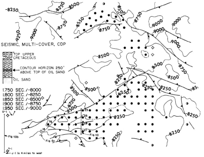
Figure 10a (Sanford Fig. 17)--Reconnaissance map based on reflection seismic survey.
Structural datum is 250 ft above top of Sarir
Sandstone. CI = 250 ft.
Figure 10a (Sanford Fig. 17)--Reconnaissance map based on reflection seismic survey.
Structural datum is 250 ft above top of Sarir
Sandstone. CI = 250 ft.