 Click
on image for enlargement.
Click
on image for enlargement.
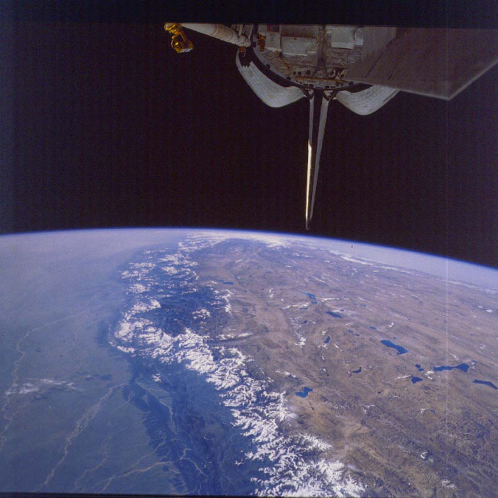
Figure 26. Photograph 17-120-023. West along the Himalaya Mountains, with the plains of India on the left and the Tibetan Plateau on the right. Overview of the landmarks that lead from the distance to Mt. Everest in the near foreground. The Tibetan Plateau averages about 15,000 ft above sea level, with the Himalaya Mountains rising above that level by as much as 14,000 ft. The mountains are being driven up and over the plains of India (left). Because the rain clouds (and monsoon) come from the Indian side, erosion and uplift are nearly balanced.
Because the Shuttle always flies east (towards us in this view), either from upper left to lower right, or from upper right to lower left, the landmarks that help to locate Mt. Everest will be described on successive slides from the distant lakes and faults to the near landmarks that specifically pin down the location of Mt. Everest (The family pronunciation for their name is “Eve-rest”!!).
An interactive internet tutorial “How to find Mt. Everest from space” can be found at http://eol.jsc.nasa.gov/education/Everest/.
From below the tip of the tail, the Karakoram fault extends toward the lower left to where it meets the valley of the Brahmaputra River, which runs parallel to the mountain front, but on the Tibetan Plateau. The river lies in the suture between the Indian Plate (left) and the Asian Plate (right). Extending from the tail tip to the right is the Altyn Tagh fault that marks the boundary between the Tibetan Plateau (near) and the Tarim Basin (far). These are strike-slip faults which cause the Tibetan Plateau to be pushed to the east (toward the lower right).
The next slide covers the region near the junction of the Karakoram fault and the Brahmaputra River. As the details are described in the next series of slides, this overview picture will be useful to return to and integrate the features identified.