 Click
on image for enlargement.
Click
on image for enlargement.
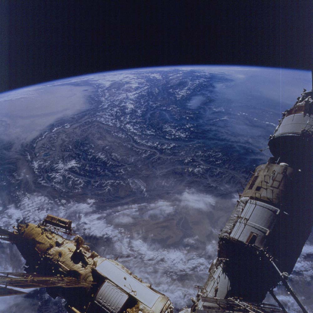
Figure 24. Photograph 79-789-072. View east past Mir, to the Pamir Mountains and beyond to the Tibetan Plateau. Curving around the right side of the high, desert valleys (all over 12,000 ft) is the Wakhan Valley (center of frame), one of the main Silk Road routes across this high region. Marco Polo traveled up that valley.
The snow-capped range on the left is the Pamir; on the right, the mass of mountain ranges are the Hindu Kush. Beyond lies a crescent-shaped valley (bluish) in which the Indus and Gilgit Rivers flow. They outline the Kohistan Arc, an island arc accreted to Asia before the Indian Plate collided. The Indian Plate underlies the low, hazy country on the far right as well as the Himalaya Mountains to its left. The Valley of Kashmir is the large elongate cloud-covered valley in the lower part of the Himalaya.
The lowest pass across this region to the Tarim Depression (Takla Makan Desert, the dust-covered region on the left skyline) is in the valley near the left edge (elevations reaching barely 11,000 ft), the Kyzyl River valley. The Talas-Fergana fault, a major strike-slip fault, extends off the frame to the left just where the Kyzyl valley enters the Tarim basin. The south flank of the Kyzyl valley marks the northernmost thrust of the oncoming Pamir-Hindu Kush block. The far edge of this block is marked by the Karakoram fault, a major right-handed strike-slip fault, which extends as a straight valley to the upper right from the bend at the right edge of the Tarim Basin, The bend is occupied by the Kunlun Mountains and the boundary with the Tarim Basin and the Kunlun Mountains and Tibetan Plateau is marked by the left-handed strike-slip fault that continues for several hundred more miles beyond the horizon.