 Click
on image for enlargement.
Click
on image for enlargement.
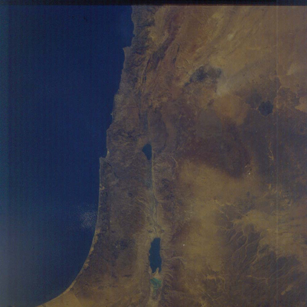
Figure 20. Photograph 17-120-056. Near vertical view of the Dead Sea segment of the Dead Sea fault. North is to the top of the frame. The Dead Sea occupies the current basin with the only significant drainage coming in from the north- the Jordan River. South of it is the salt-filled earlier basin. Further south is the fluvial filling (extends beyond the frame) of the first episode of faulting.
About 40 miles separates Jerusalem (gray area to the west of the north edge of the Dead Sea) and Amman, Jordan (gray area to northeast of the north end of the Dead Sea). Beirut, Lebanon fills the peninsula on the Mediterranean Sea shore near the top of the picture. Damascus, Syria lies to the east of the tan mountains and in the midst of the dark, irrigated area fed from springs along the base of the mountains. Jericho is the dark patch just north of the Dead Sea and on the west side of the valley that extends north to the Sea of Galilee. The Sea of Galilee marks another left step in the Dead Sea fault. Another left step to the north is followed northward by a strong bend to the east into the Bekaa Valley.