 Click
on image for enlargement.
Click
on image for enlargement.
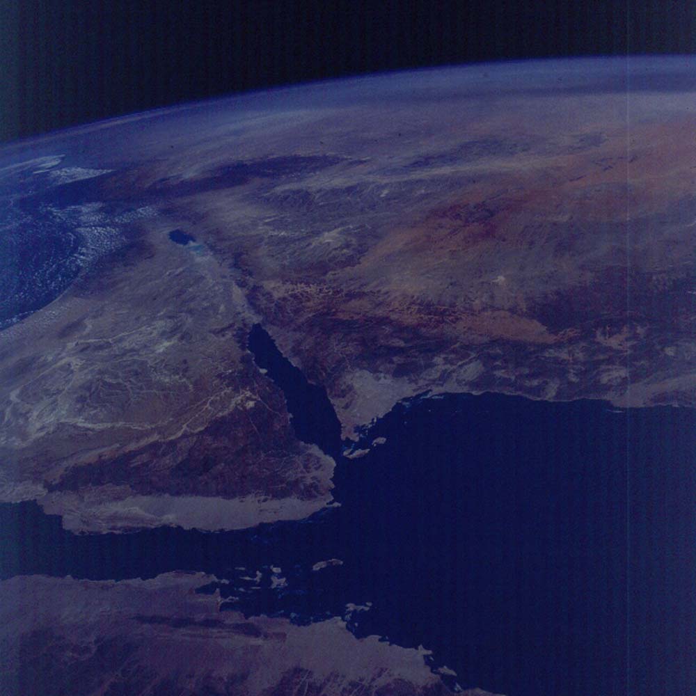
Figure 19. Photograph 43-94-78. View north across the Sinai Peninsula, along the Dead Sea fault to Syria. Shows the contrasting structures of the rifted Gulf of Suez (left) and the transform fault of the Dead Sea fault (105 km left slip; two-thirds of the length of the Gulf of Aqaba). The Dead Sea fault makes left steps under the Gulf that opens the gulf to the sea. The Dead Sea beyond lies in another left step.
Mt. Sinai lies in the center of the Precambrian basement exposures in the near field of the Sinai Peninsula. Beyond, the sedimentary cover of Nubian Sandstone (ruddy color) and the overlying limestones form the cap of the peninsula.
In the upper right can be seen the smoke plume from the burning oil wells of Kuwait, August 1981.