 Click
on image for enlargement.
Click
on image for enlargement.
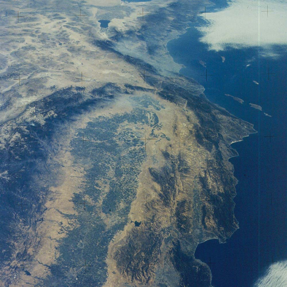
Figure 11. Photograph SL3-121-2375. View south down the San Joaquin Valley to Los Angeles and on to Baja California. The San Andreas fault lies between the brown mountains and surrounding land and the green valleys near Monterey Bay (lower right). The fault extends southward to where it makes a sharp bend to the left and continues along the southern margin of the Mojave Desert (triangular brown area), through the mountains to the left side of the Salton Sea, where it makes a right step and disappears into the northern end of the Gulf of California (top center).
This picture was taken from Skylab 3 during the summer of 1973. Comments by astronauts who have flown during this period and later during the Shuttle era say the sky is murkier now than it was at that time.