 Click
on image for enlargement.
Click
on image for enlargement.
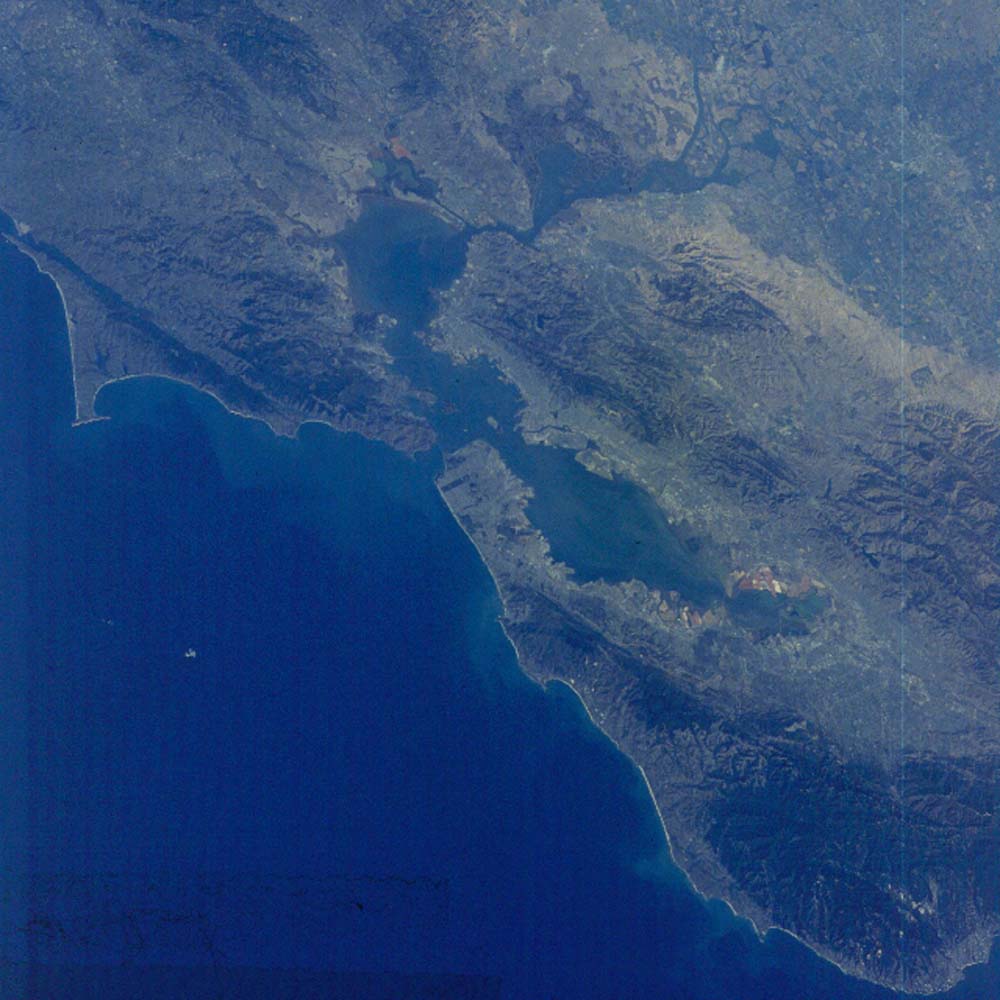
Figure 10. Photograph 61A-46-039. View northeast across San Francisco Bay. The San Andreas fault can be traced south from Tomales Bay (near upper left edge), to the entrance of San Francisco Bay to back on land in South San Francisco (color line from dark closer to us to lighter [all houses]), and continuing along the color break southeast to where it leaves the picture in the lower right side. San Jose occupies the valley south of the bay. The Hayward fault lies at the base of the mountains along the east (far) side of the bay. The football stadium of the University of California at Berkeley straddles this fault. Another splay (Calaveras fault) diverges to the north and lies on the east side of the Hayward Hills.
The delta region of the San Joaquin and Sacramento Rivers at the west edge of the Great Valley of California has been extensively modified into agricultural land.
The Sonoma and Napa Valley wine country lies along the top edge of the picture.