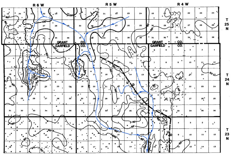
Figure 14--Woodford isopach map showing change in direction of the paleodrainage around the Hunter structure, Garfield County.
Figure 14--Woodford isopach map showing change in direction of the paleodrainage around the Hunter structure, Garfield County.