Click on each image to display larger version.
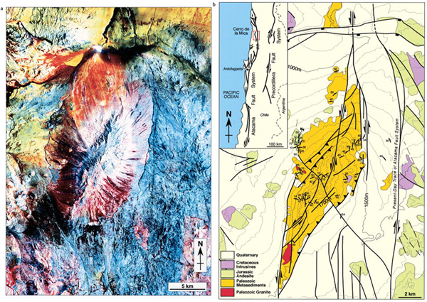
Figure 21. (a) Landsat image of the Cerro de la Mica, Atacama strike-slip fault system, northern Chile. (b) Structural map of the Cerro de la Mica, northern Chile (map data courtesy of J. Reijs [1997, personal communication]).