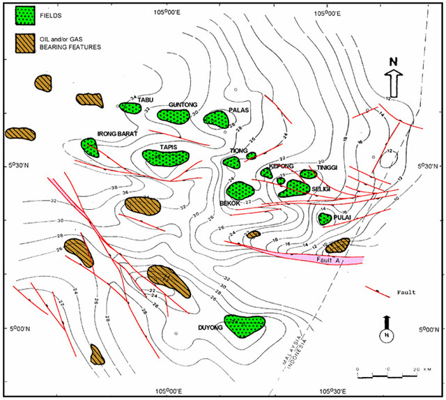
Figure 5-Structural map of southeastern Malay Basin on top of Pulai Sandstone (late Oligocene?early Miocene), as determined from seismic reflections, with location of fields, hydrocarbon-bearing structures, and well control. Faults show primarily east-west and northwest trends.