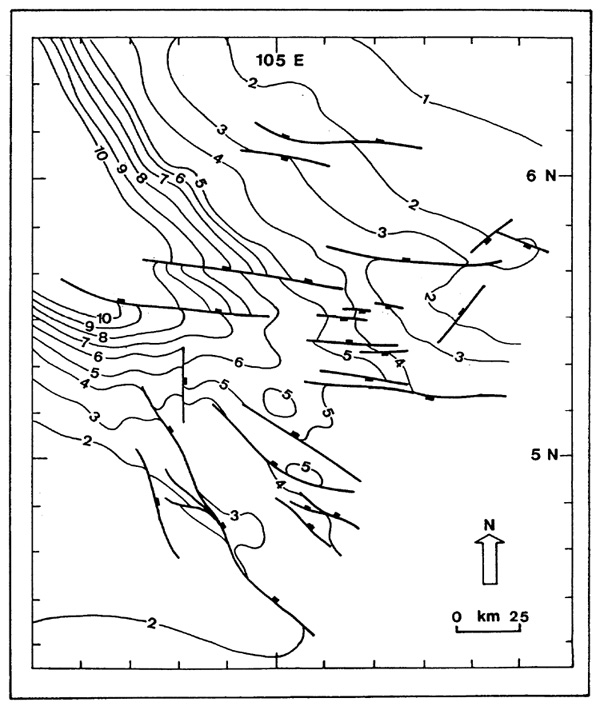
Figure 4-Basement structure map, southeastern Malay basin, showing primarily east-west- and northwest-trending faults (modified after Esso, 1976, and Carigali, 1985). Contours in km.
Figure 4-Basement structure map, southeastern Malay basin, showing primarily east-west- and northwest-trending faults (modified after Esso, 1976, and Carigali, 1985). Contours in km.