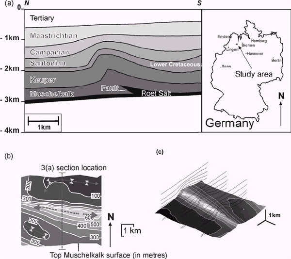
Figure 3. Present-day geometry of the contractional fault-related fold from the NW German Basin. (a) Cross section, with 0m datum representing sea level, showing a representative geometry of the structure. Inset map illustrates the study area location of the fold. (b) Map showing the present-day relative structural relief of the Top Muschelkalk surface and the location of cross section in Figure 3a. The contour interval is 100m and relative to the lowest point on the surface in order to emphasize the relative structural relief. Arrows are used to highlight the fold axes, including the relatively minor synclinal features. (c) Orthographic view of the Top Muschelkalk surface.