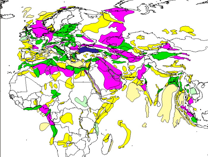
Figure 1. Vectorized map of sedimentary provinces of Middle East and Europe, along with parts of Asia and Africa (from map of St. John, Bally, and Klemme, 1984), with productivity or potential shown by color (red or pink with giant field(s), green with subgiant field(s), yellow nonproductive).