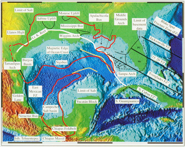
Figure 10. Present day map of the Gulf of Mexico region, showing key geological elements addressed in this month’s article. Note the abrupt terminations of known basement units in southern Florida that we consider were truncated by transcurrent motion on our "Everglades Fracture Zone." Also note the change in trend of East Mexican Marginal Fault Zone supporting the concept of two stages of Gulf evolution; basement structure contour data preclude any east-west faults in Mexico from entering the Gulf during the sea-floor spreading stage. Digital bathymetry/relief after Sandwell and Smith (1997), other features from multiple sources.