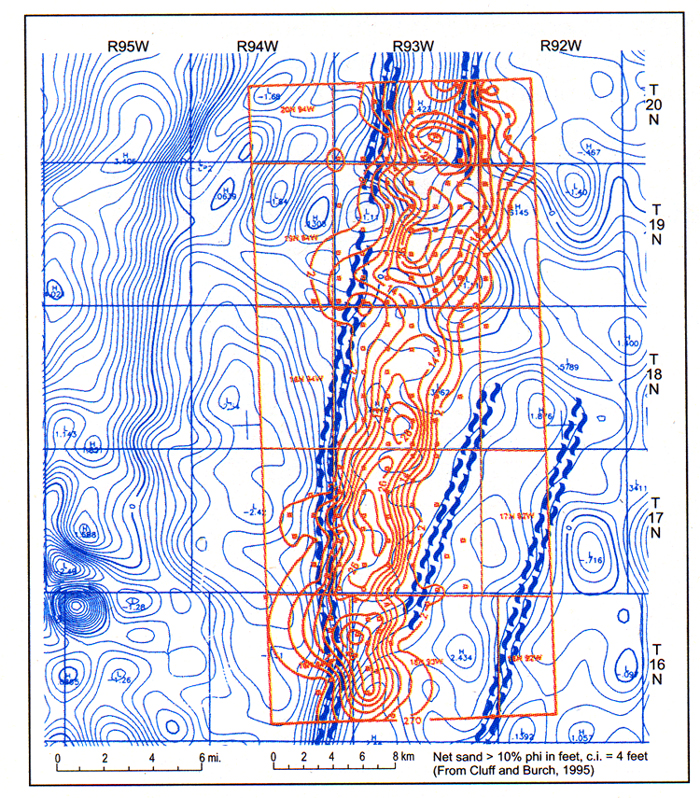
Figure 10. Echo Springs - Standard Draw - Coal Gulch Field, Sweetwater Country, Wyoming, in the Washakie Basin, > 1 tcf of gas. This Upper Cretaceous Almond sand bar, as defined by net sand isopach map (red) has been identified as a shoreline bar. It follows precisely along a basement fault interpreted from magnetic contours (blue) and is probably controlled by it (John Horne, personal communication, 1998). Movement on the fault was perhaps only a few tens of feet, and was therefore not imaged by a 3-D seismic survey run on the north part of the field (beneath limit of seismic resolution).