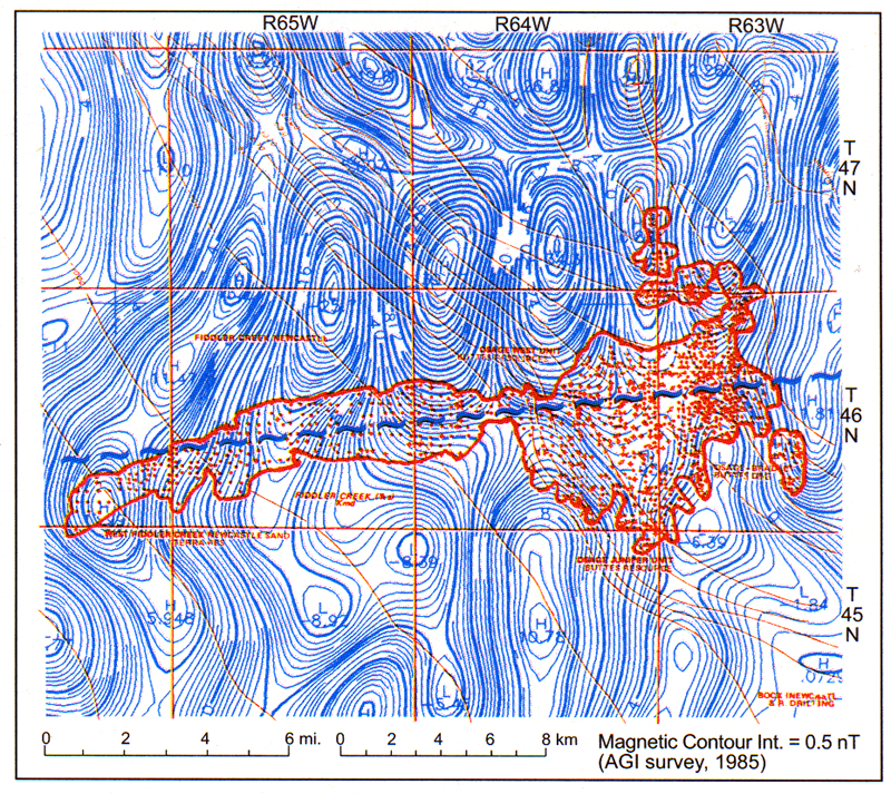
Figure 9. Outline (red) of Fiddler Creek Field, Weston County, Wyoming, superimposed on NewMag® residual contours (blue). Prominent truncation line (basement shear zone) on the magnetic map runs precisely down the long axis of the field. The field produces from lower Cretaceous Muddy formation, a fluvial sandstone. Well-spot map courtesy of Barlow and Haun, Inc. (1987).