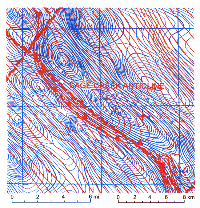
Figure 5. Sage Creek anticline, Fremont County, Wyoming. This well known thrust-fold structure in the Wind River Basin resulted from Laramide NE-SW directed compression. Note the location of basement shear zone (red) to the east of thrust at Dakota level, indicating NE dip as mapped by well data. This is one of a chain of anticlines 70 miles (105 km) long that correlates 100% with magnetically mapped basement shear zones.