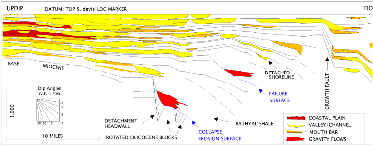
Figure 5. Stratigraphic dip section hung on the Lower Miocene S. davisi marker. The section is about 30 mi. long and connects 20 wells. Facies/environment interpretations are based on integration with dense, nearby well control. Inferred coastal-plain deposits are variable sand/shale mixtures. The downdip part of the section is in the vicinity of the prograding, growth-faulted shelf margin. Individual channel/valley features include units that are replaced downdip by mouth bars, and units that continue basinward to the limit of well control (see Edwards, 1994). Modified from Edwards (1994).