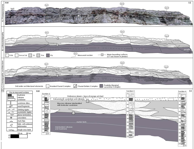
Figure 2. A) Detailed panorama of the northeastern cliff face at the Har Hotol locality, northern East Gobi basin. Cliffs shown here are approximately 200 meters long by 25 meters high. B) Outcorp map showing lithostratigraphic units and major bounding surfaces (SVb=bedded, volcaniclastic sandstone; Sm or Sd=massive or soft-sediment deformed sandstone; Fm=massive silt or mudstone; Fb=bedded mudstone or siltsone). C) Outcrop map showing main 3rd order architectural elements. D) Schematic stratigraphic cross-section for this cliff face. Sections are flattened at the base of capping ash layer, and channel outlines are shown schematically based on outcrop.