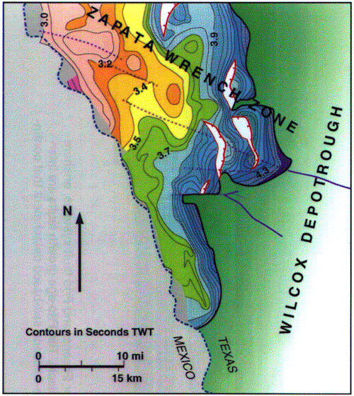
Figure 29-Seismic time-structure map of Lower Cretaceous horizon near the Mexican border showing offset of collapse edge (outlined in Figure 30) along the trend of basement faults (purple) that offset the base of the Louann. Northwest-trending anticline represents reactivation of the fault system during Laramide compression related to the Coahuila foldbelt in northeastern Mexico.