Locate the cursor over the seismic line of interest or figure reference, click on item to open section or figure.
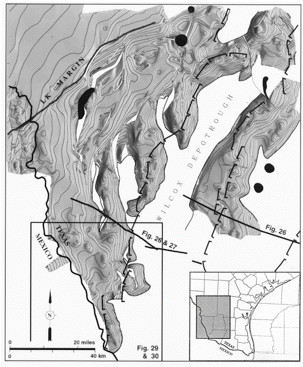
Figure 28-Shaded relief map of the structure on a Lower Cretaceous horizon, southern Texas. Lower Cretaceous strata are absent from prominent depotroughs for Wilcox deposition. Bracket symbols indicate generalized traces of Tertiary growth faults. LK = Lower Cretaceous. See inset map for location.