![]()
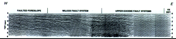
Figure 26-Sequence of uninterpreted regional seismic profile and interpreted drawing across the Wilcox and upper Eocene fault systems, onshore southern Texas. YEG = Eocene Yegua, QC = Eocene Queen City, Wx = Eocene Wilcox, LK = Lower Cretaceous, BS = basement of Jurassic Louann salt. See Figure 2 for location.