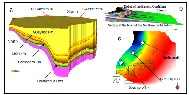
Figure 1. Location of the main features. (a) N-S view of the 3D model showing the thickness change of the various formations. At the surface in red the main fields, the red line westward is the position of the Guaicaramo thrust. (b) Oblique view, towards the north to show the relative depth of the foreland versus the Eastern Cordillera elevation and the simplifications made under the thrusts to model equivalent kitchens using software allowing only vertical displacements. (c) Top view with the position of the 3 profiles shown in Figure 2, the blocks are the exploration areas. White stars: location of the fictive wells presented in Figure 2.