Click image to view enlargement.
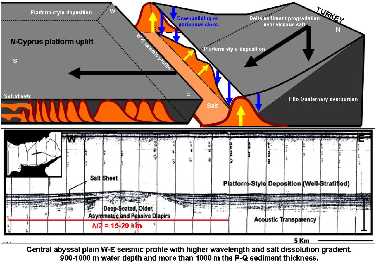
Figure 4. W-E seismic profile, central abyssal plain (lower), shows the main salt flowage to the west. This profile illustrates the greatest half-wavelength of passive diapir (15-20 km). Water depth: 900-100 m; Plio-Quaternary sediments: greater than 1000 m thick. Simplified 3D-basin model (upper) of the salt-sediment-fold dynamics (e.g., doming, downbuilding, diapir migration to the south with salt-sheet flows) indicated in profile. Scale is the same in Figure 2.