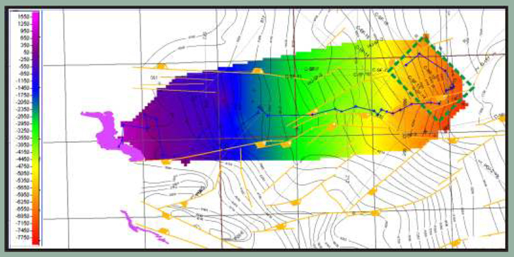
Figure 2-3. The Woodford horizon picked on a grid of 2D seismic lines. The horizon has been rudimentarily depth converted. The resulting map shows the relative basinward dip of the Woodford from approximately 900 ft at outcrop to over 7500 ft within 3D survey area.